

On our penultimate day at Duinrell, I had chance to head out for a bike ride while the rest of the family headed for a different kind of ride in the theme park. Looking for somewhere new to go, I set my sights on Zoetermeer, having never been there before.
Now, I have to say I didn’t know a great deal about Zoetermeer before heading there. Though I remembered the reason we’d not been there before was because it tends not to feature highly on the list of places to visit. But as it looked like a nice ride getting there, I thought I’d give it a go.
Zoetermeer is quite a new city. It was a small village until the 1960s, but has grown significantly since then. It’s now made up of 10 neighbourhoods, most of which are much newer than the original village.

The Dorp neighbourhood covers the territory of the original village and has the feel of an old Dutch town. The neighbourhoods outside of Dorp are much more modern and very reminiscent of British new towns like Skelmersdale, Runcorn or Milton Keynes.
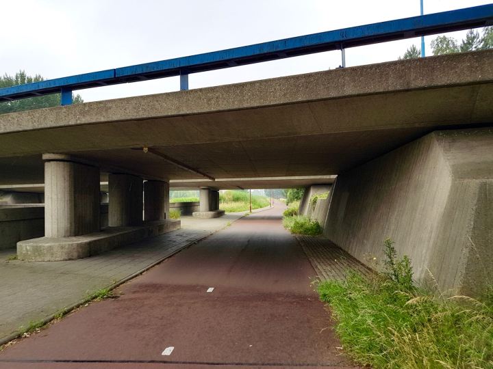
I left Duinrell, turning right out of the entrance onto Storm van ‘s-Gravesandeweg. After two weeks of glorious sunshine, it looked like rain was on the way as I left. I carried on until I reached Rust en Vreugdlaan where I turned left and then right onto the cycleway next to the N44.

I continued until I reached the junction with Houtlaan, where I crossed the N44 using the walking and cycling tunnel. While the tunnel was pretty convenient for crossing the N44, it doesn’t score highly when it comes to social safety. I felt very enclosed in there and there wasn’t clear sight of the exit. Probably not somewhere I’d want to be at night.

Once out of the tunnel, I turned left onto Raaphorstlaan, which was a quiet country road. As I got further away from the N44, things turned greener and the houses got bigger.
At the end of Raaphorstlaan I turned right onto Horst en Voordelaan. This started as a another quiet country road before it turned into a cycleway with no motor traffic. I carried on, passing over some small bridges and enjoyed some lovely views of the Dutch countryside.

Carrying on, the cycleway ended and Horst en Voordelaan returned. I assume at some point, this was a single road open to motor traffic. Converting the road to a cycleway acts as a convenient filter to motor traffic.
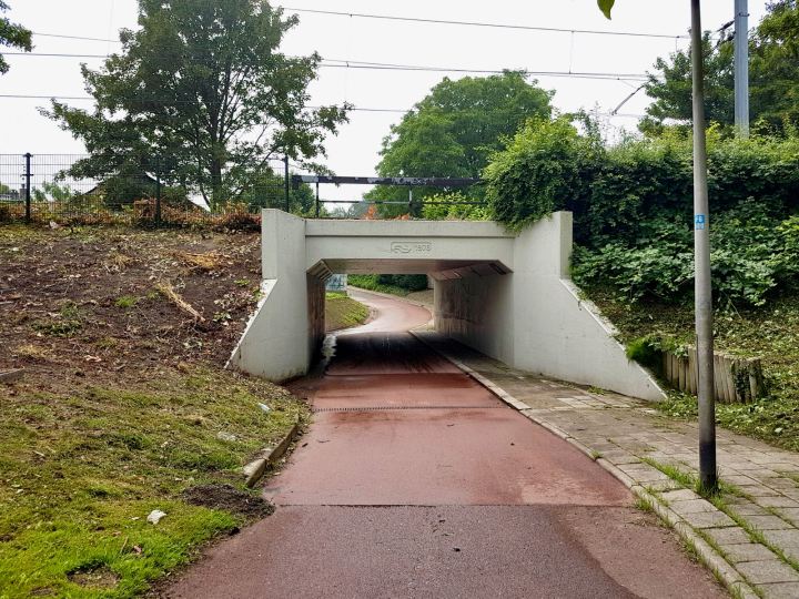
The road took a left and went down into a tunnel, passing under the main railway line from The Hague to Amsterdam. This was quite a long tunnel and felt a little over-engineered, given how quiet it was. Again, maybe this is because it used to be a through route. It did feel a little disconcerting passing through the tunnel as it was shared with motor traffic.
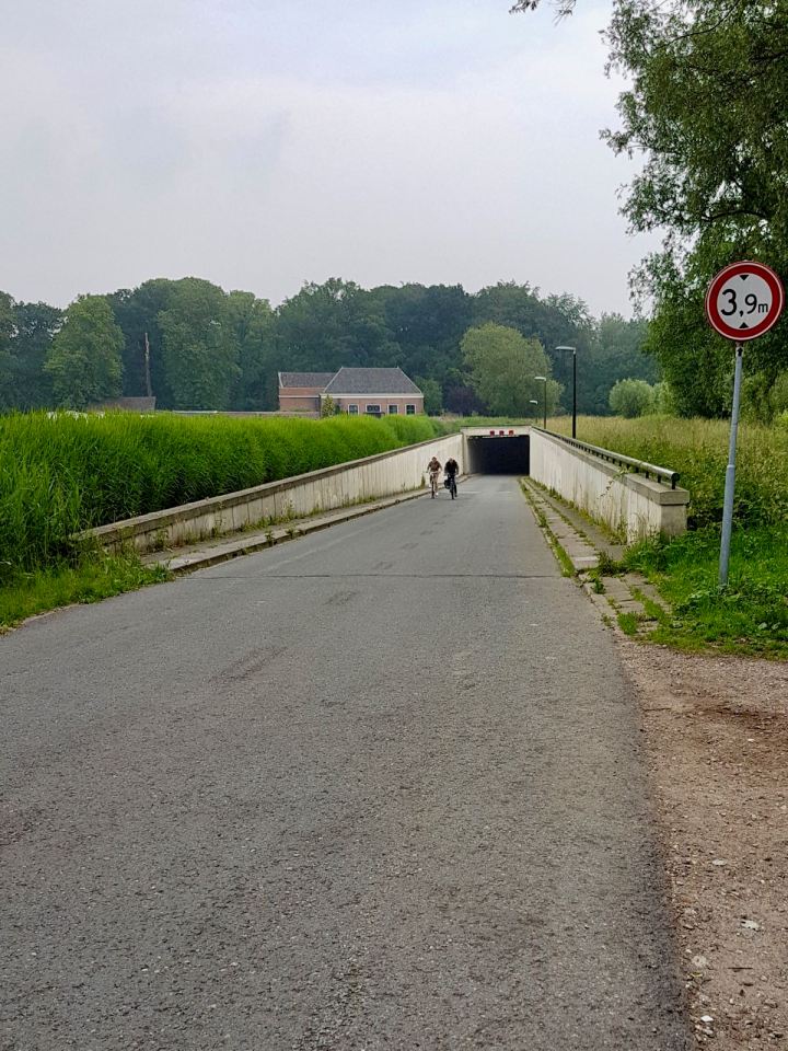
After the tunnel, the road continued to the right, turning into Horstlaan. This carried on as a very straight and narrow road, until it reached the N447. I rode under the N447, using the walking and cycling underpass, I then turned onto Kniplaan.
Riding along Kniplaan, I passed by some greenhouses that seemed quite large, but are probably quite small by Dutch standards. Kniplaan carried on straight, with some lovely tall trees. Before reaching the end of the road, I turned left onto another cycleway.

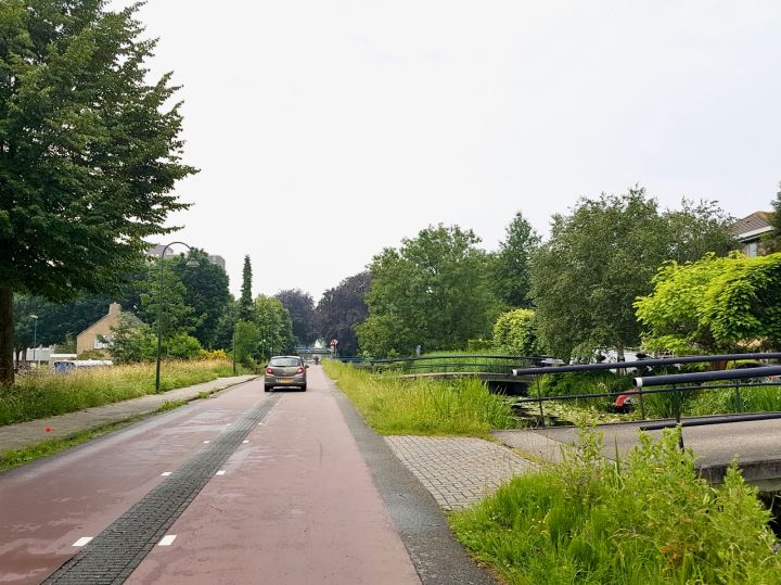
Turning the corner, I reached a lifting bridge over the Vliet canal. The bridge was already up as a few boats passed under. This was quite a charming and picturesque spot, so I didn’t mind waiting.
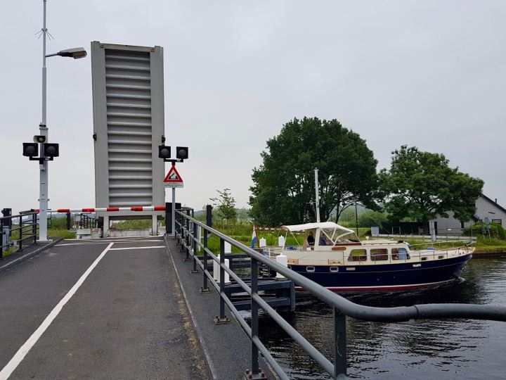
Once over the bridge, the cycleway turned to the right, before joining Kniplaan. I then turned right onto a different cycleway running parallel to the road. This passed through the lakes at Vlietland. Though, due to the tall vegetation, I wasn’t able to see much of it.
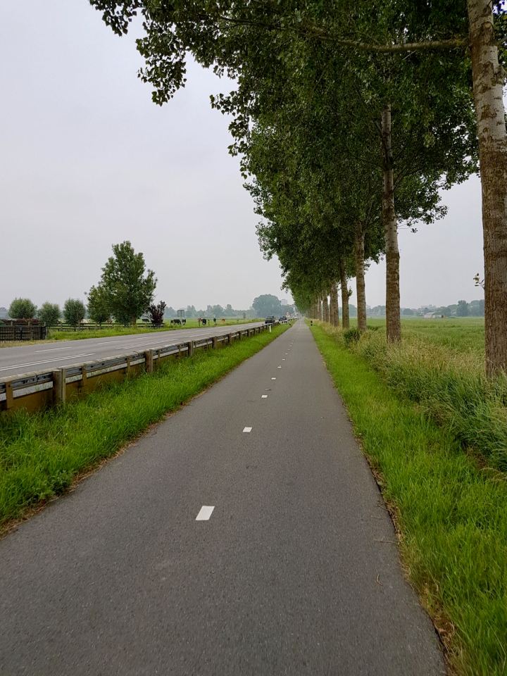
Carrying on straight, I reached the bridge over the A4 motorway, which runs from Rotterdam up to Amsterdam. I then came to the end of Kniplaan, turned left onto Doctor van Noortstraat and right onto the cycleway Fietspad 90. Along here, I passed a number of cattle farms and very flat polder scenery. It might not be to everyone’s tastes, but I love that kind of thing!

At the end of the cycleway, I turned left onto a road, Meer- en Geerweg. This carried on for a short distance, before reaching the N206. At this point I turned right onto another cycleway, running parallel to the road. This one was lined with trees and seemed to stretch on for miles.
In the distance through the trees, I could see something rising out of the otherwise flat landscape. This turned out to be the SnowWorld Zoetermeer snowdome. I passed closer to this later, on the way back.
I soon arrived at the outskirts of Zoetermeer and the asphalt cycleway changed to a paved one. This was obviously added some time ago as it was a little dated, though this didn’t matter as it was perfectly fine.

Following a roundabout, I continued onto Zwaardslootseweg. I then turned left onto Europaweg, which is the ring road around Zoetermeer. As you’d expect, this is a wide multi-lane dual carriageway, just as you’d see in the UK. Though the difference here is a wide bidirectional cycleway running alongside.

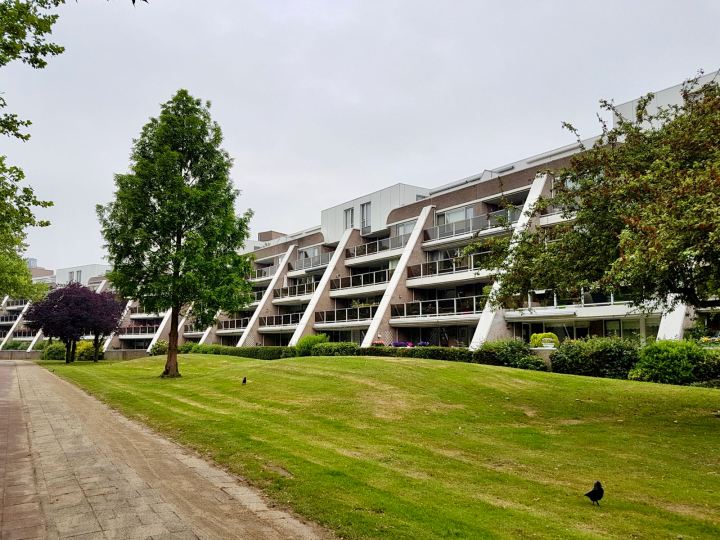
I next took a right and headed towards the city centre. At this point, I got a little lost and the rain started to come down, so I wasn’t best pleased! I continued down Frankrijklaan and through a residential area, before arriving at the Stadshart Zoetermeer shopping mall. With the mix of concrete and 70s/80s architecture, I really did feel like I was in Milton Keynes!
I had hoped to arrive at the Dorp neighbourhood, where the original village was. Though by following Google Maps, I ended up at a shopping mall. So it was time to dig out my phone and work out how to get there.
I eventually arrived on Dorpsstraat, where I parked up and went off to find some lunch. After enjoying some Uitsmijter and cheesecake in the rather nice De Bakkerswinkel, I headed out, pleased to see the rain had stopped.

Getting back on my bike, I decided to take a detour on the way back to see the Burgemeester Jan Waaijerbrug bridge. After reading all about this bridge on Bicycle Dutch, I just had to go and have a look.
I set off down Dorpstraat, which soon turned into Vlamingstraat. I then turned right onto Oxfordstraat and left onto the Cambridgepad cycleway. A nod there to two British cities of course, and coincidentally both known for cycling. Though obviously nowhere near Dutch levels of cycling.
Passing under railway tracks, I was soon back on Vlamingstraat. The road runs alongside a small canal with many little bridges over the water to houses. It’s very picturesque. Following a junction, the road turns into Voorweg and becomes a fietstraat (cycle street).
I continued down Voorweg until I reached the Overwest cycleway. This took me up over the railway tracks and past Centrum-West station. The cycleway then went down and past a shopping centre, before heading under Europaweg in a walking and cycling underpass. This area seemed quite new and the cycling infrastructure was very good.

Going through the underpass just made me wonder what could have been in my own Stretford, if the council had decided to invest in upgrading the existing subways, instead of filling them in. It could have been as safe and convenient as this, whereas we now have dangerous and unpleasant crossings that take an age to cross.
Once out of the underpass, I turned left and continued on the cycleway that runs parallel to Europaweg. This looked like it had been here for some time, but it was set back from the road, very green and pleasant to cycle along.

I continued along Europaweg, passing some junctions and roundabouts, all with dedicated space for cycling and feeling very safe. Soon, I could see the Burgemeester Jan Waaijerbrug bridge in the distance.

It really is a very impressive structure. The sweeping lines and curves look fantastic from any angle. The lights with their discs, looking almost like rows of flying saucers going off into the distance.

They could have easily chosen to build a very functional and dull crossing here. Something like the underpass at the Voorweg roundabout nearby. But they chose to build something that makes a statement and adds to the scenery. The fact that it’s for people walking and cycling, shows the importance placed on those modes of travel.

Approaching the bridge, I rode up the ramp taking me up at a gentle gradient. Riding on the bridge gave me fantastic views across the flat landscape and the cycleway, road and railway tracks I was passing over.

I was now able to get a better look at the bridge’s construction and materials. The bridge is made of weathering steel and has a layer of rust on the surface that acts as a protective coating. It has a rough texture to touch, looks amazing and the colour makes it sill well in the countryside.

I was so impressed with this bridge, it was well worth the detour on the way back. After heading over the other side, I spent a little time looking at the details, taking pictures and admiring the view.
I crossed over the bridge and headed off to rejoin the route back to Wassenaar and Duinrell. I rode back along Europaweg, following the route I came, turned left at the Voorweg roundabout and carried on down Voorweg. There were many bridges passing over the water next to the road, including an incredibly quaint looking petrol station over a wooden bridge.

I turned off Voorweg and onto the Stompwijksepad cycleway. This took me past SnowWorld Zoetermeer and Buytenpark to the right and allotments and agricultural land to the left. Buytenpark used to be a landfill site that was covered in soil and turned into natural looking hills back in the 1980s. It’s now filled with nature and there’s lots to see, though I didn’t get chance to have a look round.

By now, the earlier rain had given way to lots of lovely sunshine. I carried on along Stompwijksepad, passing over a small bridge and onto Meerpolder. At this point, I was surrounded by a very flat polder landscape and plenty of agriculture. I soon arrived at fietspad 90, joining up with the route I took on the way there.

I continued back along the route I came, though now in the sunshine rather than rain. I passed over the A4 motorway, waited for boats at the lifting bridge over the Vliet canal, took the tunnels under the railway tracks and N44, to arrive back in Wassenaar and Duinrell.
While Zoetermeer might not be at the top of any tourist guides, there’s a lovely town at its heart. If you like a bit of modern/postmodern architecture and are fond of concrete, you’ll love the other neighbourhoods too.
The ride there from Duinrell takes you through some fantastic scenery and is well worth doing in itself. The cycling infrastructure in and around Zoetermeer is also well worth experiencing. It’s a true network of safe routes and a pleasure to ride round.


Back to part 9 – Around Wassenaar
