

The Dutch are renowned for their skills at reclaiming land and controlling the sea, they’ve been doing it for centuries. Anyone with a basic knowledge of Dutch geography will know that much of the land in The Netherlands is below sea level, and is protected by dikes, keeping the sea at bay.
The Houtribdijk is actually a dam, rather than a dike. It forms part of the Zuiderzee Works and was built between 1963 and 1975. It is 27km long and connects Enkhuizen to Lelystad.
The Zuiderzee Works are a series of dams, dikes and land reclamation. The works involved damming the Zuiderzee, with the Afsluitdijk and the Houtribdijk. This split the Zuiderzee into two fresh water lakes, the IJsselmeer and the Markermeer.

The Houtribdijk separates the IJsselmeer and the Markermeer. The dam also carries the N302, enabling you to drive between Enkhuizen and Lelystad. It also has a cycleway alongside the N302, but at the time of our visit, this partially closed, due to ongoing works.
While staying nearby in Bovenkarspel, I headed out for a brief ride on the Houtribdijk in the late afternoon. I was by no means attempting the whole 27km, just a short section around Enkhuizen and the naviduct. If you want to see more of the route, have a look at Cycling on water, crossing the Houtribdijk.
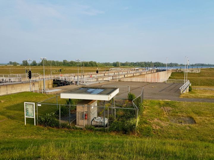
After following the route to Enkhuizen I’ve ridden before, I turned right onto the N302 at the start of the route. I carried along the cycleway and onto the Houtribdijk. Soon, I passed a control tower, then over the locks for commercial boats and a lifting bridge.

Next, I passed the sluices that are used to maintain the levels between IJsselmeer and Markermeer. The two lakes should be at the same target level, but wind surge and feed flows affects them differently.
The cycleway then split off from the N302 and joined a local road, Sluisweg. This appears to be there to enable motor vehicle access to the naviduct at ground level. I carried on a bit further and was back on a dedicated cycleway.
I passed under the naviduct, along with the N302, carried on a little further, then decided to turn back and explore the naviduct at ground level.

Wikipedia tells me that a naviduct is a navigable aqueduct with locks. The naviduct on the Houtribdijk is the first and only example, though apparently the Dutch government is considering building more. This naviduct enables both leisure and commercial boats to cross between IJsselmeer and Markermeer.
I rode back along Sluisweg, then turned right onto the road that runs up to the naviduct at ground level. From there, I had a great view of the control tower, locks and aqueduct as well as Enkhuizen.
The following drone footage, courtesy of Aerial Drone Horizon shows the Houtribdijk and naviduct in all their glory. This is fantastic and well worth watching.
I now headed back along the cycleway next to the N302 and to our holiday home. Although this was just a brief ride onto the Houtribdijk, I really enjoyed having a look round. I’m fascinated by these pieces of massive Dutch infrastructure.
I had hoped to record the whole ride on my camera, but I ran out of storage space without realising! Oh well. I did manage to record the ride back from the naviduct though.


Back to part 5 – A day out in Hoorn
Next to part 7 – The route to Madurodam
