

The second week of our Netherlands 19 trip saw us returning to Duinrell in Wassenaar, near The Hague. We’ve been to Duinrell so many times now, that it’s getting a little embarrassing. This was our 9th visit!
While staying at Duinrell, I usually try and get out on the bike once or twice, when everyone else is going on the rides. Unsurprisingly, the rest of the family have a limit of how many times they can stand around while I take pictures of interesting kerbs or cycleway surfaces.
So, on one day during our stay, I decided to take a short ride to Voorburg, a town situated on the outskirts of The Hague. While it may seem like it’s just a suburb of The Hague, it’s actually one of the oldest towns in The Netherlands.
Setting off from Duinrell, I headed out of Wassenaar along Storm van ‘s-Gravesandeweg and Schouwweg, then turned right towards the N44. Riding around Wassenaar is generally good. There’s lots of protected cycleways in the area. Most of them are paved and a few are a little dated now, but that’s not any real problem.

I continued along the N44, on the cycleway that runs parallel. While the N44 is pretty unpleasant, at least the cycleway is reasonably well protected from the noise and pollution.
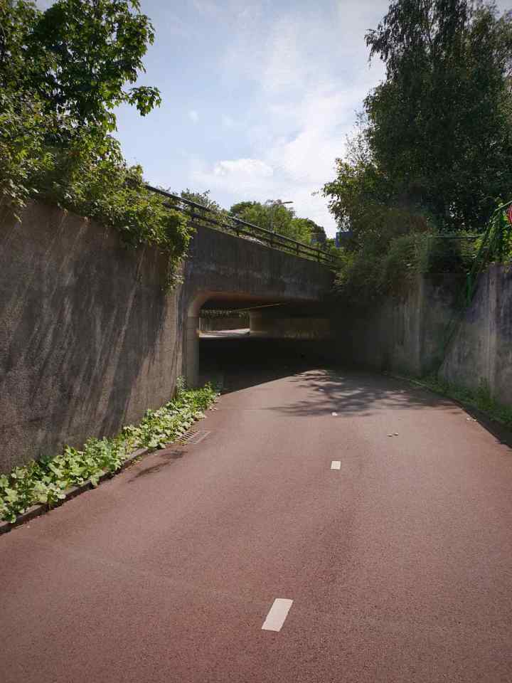
After carrying on a little while, I took the underpass under the N44. In typical Dutch style, this is a wide, clean and well lit underpass, with good lines of sight through.
Once on the other side of the N44, I headed left into Haagse Bos, a forest that used to stretch from ‘s-Gravenzande to Alkmaar and was a popular hunting area. Now it’s much smaller and just stretches from The Hague to Wassenaar.
While riding through Haagse Bos, I came across the Huis ten Bosch palace. This is one of three royal palaces of the Dutch royal family. It dates back to 1645 and looks impressive in its setting in the forest.

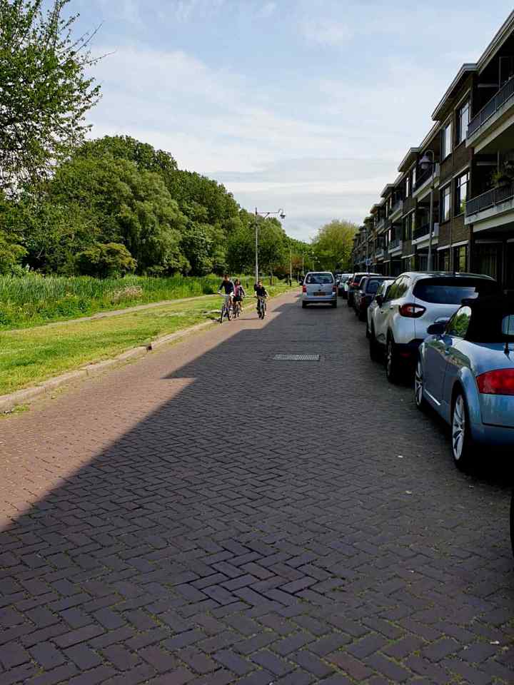
I took a few photos, then got back on the bike and carried on. I left the Haagse Bos and crossed over Bezuidenhoutseweg onto Carel Reinierszkade. This was mostly a quiet route with no cycling infrastructure to speak of.
Along the route, I passed some bike hangars on De Eerensplein. I can’t say for certain, but I think these might be the first residential bike hangars I’ve seen in The Netherlands. With Dutch bikes being robust and able to be out in all weathers, I guess there isn’t that much demand for covered on-street parking.

Carrying on, I passed the rather picturesque Nieuwe Veenmolen windmill. This houses Restaurant Christian, a restaurant in a rather impressive setting.

Not far from the windmill, I passed through a couple of rather uniquely decorated train underpasses, known as the Vincent van Gogh tunnels. These were decorated by young people from Bezuidenhout, under the direction of the artist Damir Segon.
Apparently, thousands of sunflowers bloom on the Voorburg side of the track every summer. I was there a little too early to see these though.

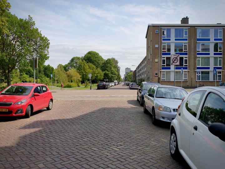
Once through tunnels, I continued onto Spinozalaan, which again, didn’t feature much in the way of cycling infrastructure along its route. It was probably busier than I’d like, with quite a few cars overtaking as I was passing the parked cars.
Getting closer to Voorburgh, a decent two-way cycleway started on the left hand side. This carried across quite a few junctions, until nearly reaching the town centre. I took a right onto Parkweg and carried on. At this point, there was just door-zone painted lanes, which weren’t particularly great, as you could imagine.
I soon arrived in the town centre, which was very typically Dutch, with lots of lovely old buildings. It’s one of the oldest towns in the Netherlands after all.
Something else typically Dutch was the main shopping street, Herenstraat. This was open to people walking and cycling, but not to motor vehicles. This creates a pleasant environment you want to spend time in. Free from the noise and air pollution created by motor vehicles.

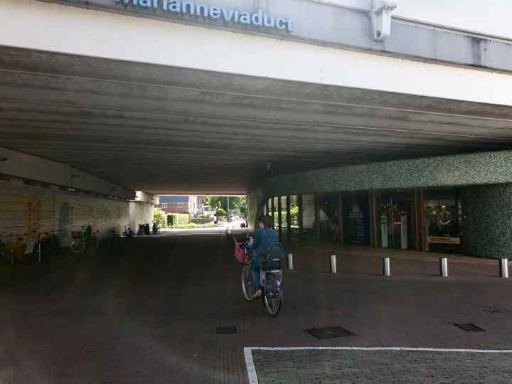
Surprisingly, at the end of Herenstraat, there was the Marianneviaduct (named after Princess Marianne, not Marianne Vos as someone suggested :-)). This overpass carries the 8 lanes of the A12 motorway, which goes from The Hague to the German border. It also carries the train line between The Hague and Gouda.
It’s a surprise just how close the viaduct is to the town centre. At first, I hadn’t realised what it was. There wasn’t really any traffic noise, so you wouldn’t have thought there was a motorway there. Passing under the viaduct was a pleasant experience. Nice and clean, with shops and cycle parking.
I wasn’t prepared for what was out the other side. The underpass opened out onto a really impressive station square, with lots of trees and interesting planting. It’s quite a large open space, with pleasant, but understated public realm. Much of this is a relatively recent development. You can see from Google Street View, this space was once dominated with car parking spaces.

Under the elevated train line, there was a significant amount of cycle parking. It was surprising to see it was quite empty. Quite unusual for station parking in The Netherlands.

Given the proximity of the A12 motorway, it’s quite surprising just how pleasant a space the station square is. I’d probably question what the air pollution levels are, with the 8 lanes of motor traffic passing through. But there wasn’t a noticeable pollution smell in the air.
After enjoying a pleasant wander around Voorburg, it was time to head back. Leaving Voorburg, I took a different route to the one I arrived on, hoping to see some more cycling infrastructure.
Just before leaving town, I spotted some interesting looking cycle parking, known as fietsvlonders or bike platforms. They’re normally used as a way to temporarily swap a car parking space for 10 bike parking spaces.
This example was very much on the footway, rather than a parking bay. Though that might be due to there being no parking bays nearby.

I started off by riding back along the painted lanes on Rozenboomlaan. Things soon improved though as I reached Prins Bernhardlaan, where the lanes changed to protected cycleways. This was mostly one-way, paved cycleways, with some two way sections.
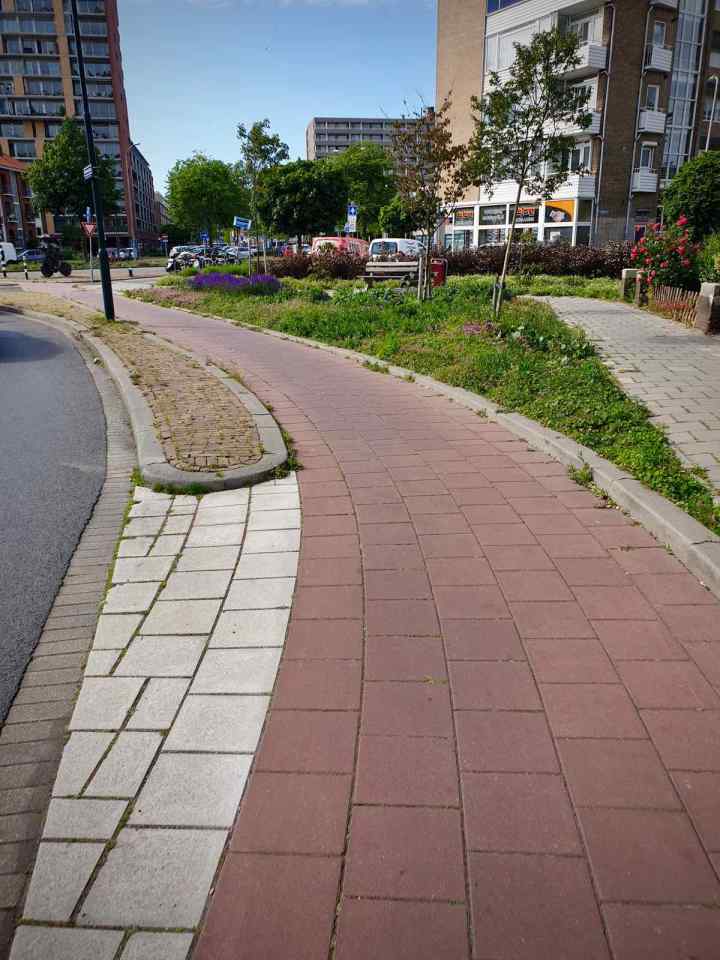
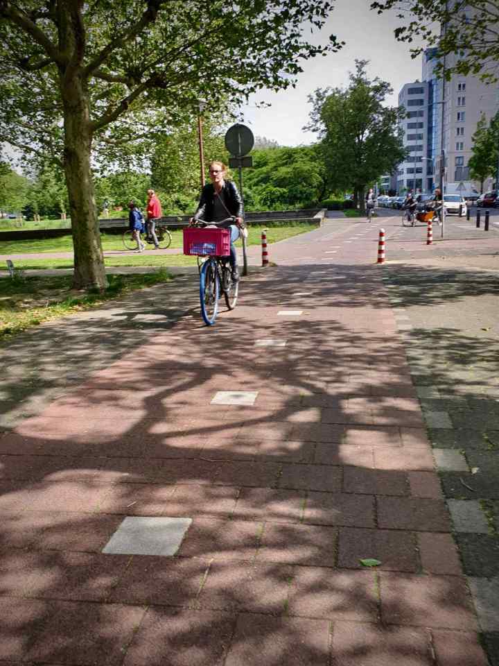
While some of the route looked a little dated, it was smooth and well maintained. There was plenty of evidence of broken paving being replaced, which is good. After turning onto Spinozalaan, I carried on onto Monseigneur van Steelaan, where the protected cycleway continued.
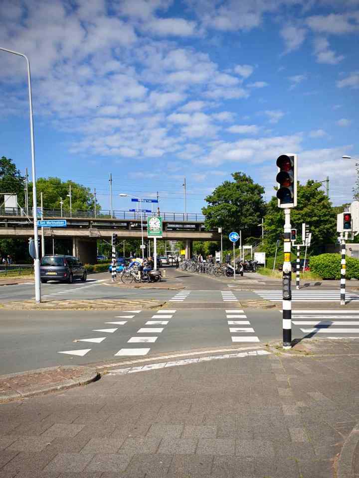
As is typical in The Netherlands, junctions were sensibly laid out, with plenty of space for bikes. There were dedicated traffic lights and phases for cycles. Crossings were set back from the road to ensure the best angle for approaching turning motor vehicles, giving maximum visibility.
I soon passed the Voorburg ‘t Loo RandstadRail station, which had plenty of cycle parking. Obviously well used, it’s another example of how cycling is so well integrated with public transport. It’s not uncommon for people to combine cycling with trams, light rail or buses as part of their commute.
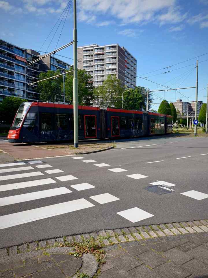
Things were looking equally positive when interacting with the local tram network, where the cycleway crosses the tracks at right angles, ensuring the safest way across for those cycling.
It’s a very different situation back home in Manchester. Poor design means there’s many conflicts with the local Metrolink tram network. Crossing angles are often poor and there are regular cases of people on bikes being injured crossing the tracks.
I carried on onto Hofzichtlaan, then Bezuidenhoutseweg. By now, the cycleway had become smooth asphalt. It also looked newer and probably a little wider.
I continued along Bezuidenhoutseweg until reaching the N14. After crossing a couple of large junctions, I was soon back at the N44 and on the parallel cycleway I was on earlier.

I was soon back at Duinrell, after a pleasant few hours exploring. While there’s so much amazing cycling stuff to see in The Netherlands, particularly the landmark developments in places like Utrecht and Amsterdam. It’s great to get out and see some ordinary cycling infrastructure like this. Well, ordinary for The Netherlands.
It’s infrastructure like this that enables people to live vastly different lives to those in the UK and elsewhere, ones that aren’t so dependent on cars.


")


Back to part 3 – Utrecht revisited
Next to part 5 – The route to Delft
