

As I mentioned in the first Netherlands 19 post, Harderwijk was the closest city to the holiday park we were staying at, Droompark Bad Hoophuizen. Just a short 8km ride away.
Harderwijk is quite an old city, dating back to 1231. Originally, it was located on the Zuiderzee shore, with a history of fishing and seafaring. Though, that came to an end when the Zuiderzee was cut off from the North Sea in 1932. There’s many clues to its historic past, including the city gates and defensive walls.
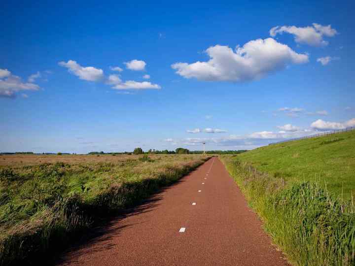
We set off from our holiday park and headed for Harderwijk along the rural cycleway, which starts as Waterweg. This wide concrete path cut through the fields as it headed inland and towards Harderwijk.
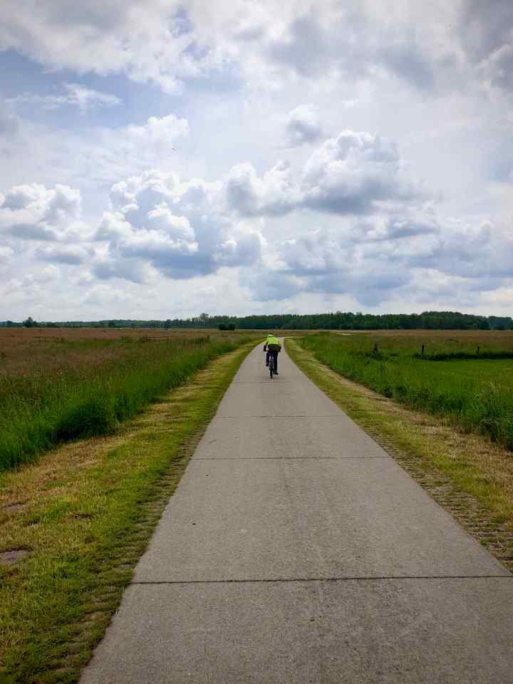
You don’t often see many concrete cycle paths, even in The Netherlands. You might think being made of concrete, it’d be quite rough and bumpy, but it wasn’t at all. It was actually a really nice smooth ride.
The benefits of concrete is its longevity and low maintenance. This is particularly true when it’s just being used for a cycleway and not having to carry heavy traffic. I wish we had a few rural paths like this in the UK, instead of loose stone surfaces that inevitably end up poorly maintained, rough and prone to standing water.
At the end of the cycleway, we carried on along onto Lageweg and passed a number of farms and houses. At this point, we were riding on quiet, paved roads.

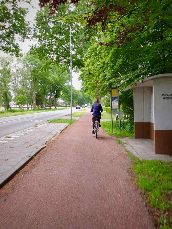
Soon, we reached Zuiderzeestraatweg, where we continued along the high quality two-way cycleway. This was a decent width, with a good surface and priority at junctions. Just what you’d expect in The Netherlands.

On the opposite side, there was also a one-way cycleway, going the other direction. This is quite common in The Netherlands, usually in busy residential areas and near shops, where there’s a need to be able to cycle both ways on the same side of the road.
Carrying on, the cycleway switched to being one-way, before it crossed over to the other side of the road and became two-way again. We passed more continuous cycleway junctions, plus some bus stop bypasses.
As we arrived in Harderwijk, the protected cycleway ended and was replaced with painted lanes on the road. This wasn’t great, as there was quite a bit of traffic and a few pinch points.
Fortunately, we soon found ourselves mostly back on protected cycleways. This included some decent Dutch-style roundabouts, with priority for bikes, which is the standard.

We came across an example of a roundabout featuring a painted lane for cycling, with the addition of some kerb protection. This wasn’t really up to the standard you’d expect from a Dutch roundabout. Though I’d imagine it’s the kind of thing a UK planner would copy and try and pass off as a Dutch roundabout. Like when people started talking about turbo roundabouts and Bedford used cycling money to build one, badly.
We were only on the roundabout briefly, but it was clear it didn’t feel as safe as on a more standard Dutch roundabout. Mainly, this was because the angles were all wrong. So those driving and cycling are not able to see each other and you’re much more likely to be hit by a turning motor vehicle who didn’t see you.
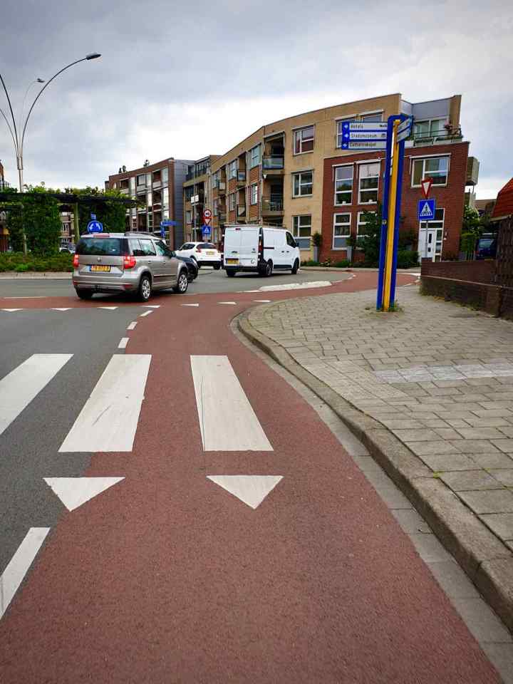
Arriving in Harderwijk, we parked up the bikes and went for a wander. Like many old Dutch cities, Harderwijk has many lovely old streets and buildings, with quite a few of those streets being traffic-free or access only.
We headed out through the city walls and towards Stadsstrand Harderwijk, the beach island in the Wolderwijd lake. On the way there, we passed a large cycle parking area, which was quiet when we arrived, but you can imagine gets pretty busy at the weekend.

Before we arrived at Stadsstrand Harderwijk, we were passed by what appeared to be a group of schoolchildren out on their bikes with their teachers, just as we saw in Nunspeet. Again, this was fantastic to see and it’s something I doubt I’d ever see back in the UK.
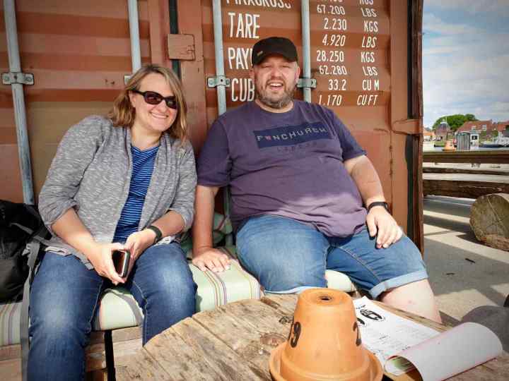
Once we got to Stadsstrand Harderwijk, the sun was out and it was lovely and warm. So what better way to spend the afternoon grabbing something to eat and drink in a bar. The bar we ended up in was Walhalla, which was pretty great with a good selection of beers and some pretty nice food.
After lunch at Walhalla, we headed for a wander and stopped off for dinner, then it was time to head back. I chose to try a new route on the way back, bringing up a different route on my trusty Google Maps (more on that later).
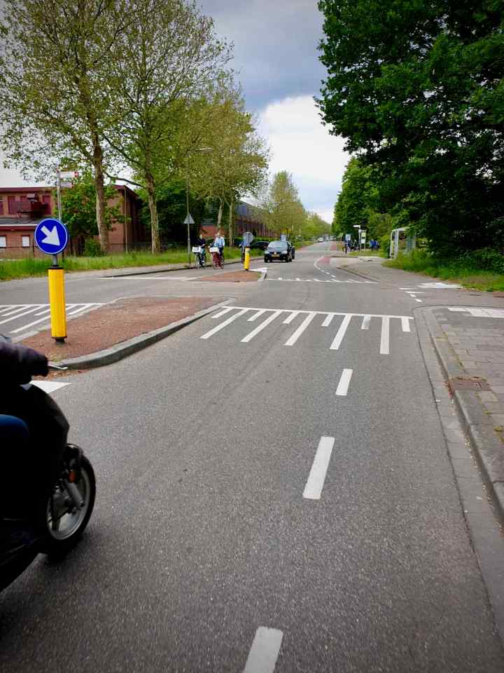
Heading out of Harderwijk on a different route gave us opportunity to see some more cycling infrastructure, starting with a rather disappointing roundabout, featuring another painted cycle lane.

Now I’m not sure of the logic of installing this roundabout, though it’s a reasonably new addition. According to Google Street View, it was added around 2015-16. Prior to this, the road went through here, with side turnings on either side.
While the rest of the work carried out at this time was a significant improvement for cycling, replacing painted lanes with a good quality two-way cycleway. The introduction of this roundabout seems like a step backwards.
Fortunately, the cycleway continues through the roundabout. So if you’re planning to go straight, you can avoid it. Though if you want to turn left or right, you’d have to use the roundabout itself.
Anyway, carrying on from there, we reached a rather nice underpass, that passes under the N302 and access roads. This appears to be older than rest of the cycleway along here, and was built when the N302 overpass was built, sometime between 2009 and 2014 according to Google Street View.
This was a fantastic example of a high quality cycling underpass, something the Dutch do really well and something we rarely see in the UK. Many of you will be aware of how underpasses are viewed in the UK. Most of ours were built a long time ago in the 60s and 70s to lower standards and never improved or even maintained.

They generally have low levels of social safety, smell questionable and are viewed as places to avoid. Many local authorities have taken the opportunity to fill in underpasses, to reduce maintenance costs, forcing people to use surface crossings. This is something we’ve seen recently in Stretford.
This underpass is really quite different to many of those UK examples. It’s wide and straight, with good lines of sight through and is nice and clean. I didn’t get chance to use it at night, but I’d also expect it is well lit.
The high quality two-way cycleway carried on beyond the underpass. We passed a couple more roundabouts that were thankfully much better than the one we passed earlier. In both cases, the cycleway was largely separate to the roundabout, other than to cross its arms.

After the second roundabout, the cycleway diverged from the road as it headed out of Harderwijk and into the countryside. At this stage, it continued as a two-way cycleway, with a smooth asphalt surface.
Now, I mentioned earlier that I was relying on Google Maps for the route back. I tend to use Google Maps quite a lot, mainly because it’s convenient on a mobile phone. Many people have suggested other apps for both the UK and Netherlands. While they have their uses in terms of planning. None of them are as easy or convenient to use as Google Maps.
Most of the time, using Google Maps is fine, if not perfect. Though in its route back to the holiday park, Google Maps decided to take us down a route that’s definitely not part of the cycle network!
It started off fine. As we left the asphalt cycleway, we carried on onto a brick paved path. Now, this was clearly laid some time ago and pretty bumpy at times. But it wasn’t that bad, so we continued.
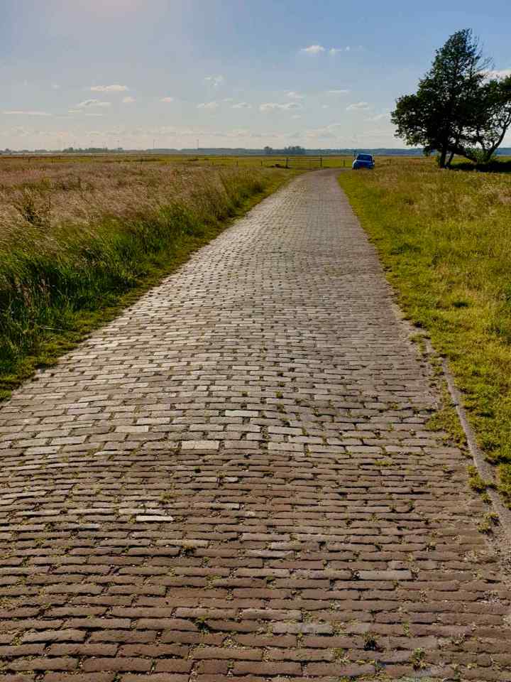
The surface of the path soon changed to loose stones and then it narrowed considerably. Now we’ve experienced far worse in the UK. Indeed, quite a lot of the UK’s National Cycle Network has a worse surface than this. So we carried on as far as we could, though it became clear we weren’t going to make it all the way on this path.

At this point, given everyone was tired and keen to get home, we turned back and looked for an alternative route. We didn’t have to go too far before we were able to take a diversion and get back onto the cycleway we went Harderwijk on in the morning.
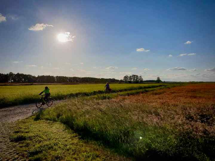
So, with the sun behind us, on what was an absolutely glorious evening, we got back on the nice smooth concrete cycleway and headed for our holiday park. On the way, we barely saw another soul. Just the odd person riding a bike or walking a dog.
The only car we saw for quite a while was one that’d been abandoned half way along the cycle route. I’m guessing, after being stolen first.

Before too long, we arrived back at our holiday park, after having a fantastic day out on the bikes, visiting a really lovely city.

Back to part 1 – The route to Nunspeet


Back to part 1 – The route to Nunspeet
Next to part 3 – Utrecht revisited
