

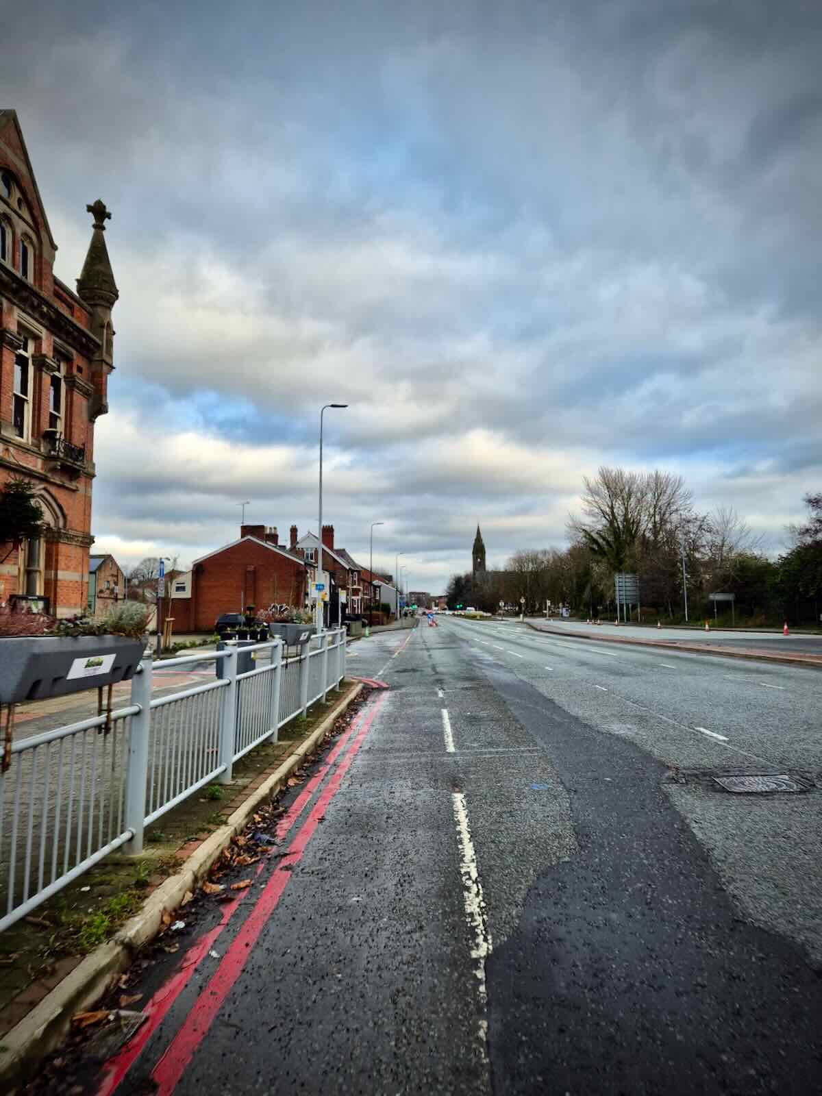
Well, what a difference a year makes! Or more accurately the 10 months since my last post on the A56 back in February 2024, when I asked if it was the end for the A56 pop-up cycle lanes. At that point, there was no apparent progress on the replacement for the pop-up scheme, with the remaining cones disappearing regularly. Well, I’m pleased to say things are now looking significantly brighter.
We’re now at the start of 2025 and work is well under way to replace those cones with something more permanent. This largely consists of light protection, using a combination of wand-separated cycle lanes and bus stop bypasses at most of the bus stops along this section of the A56.
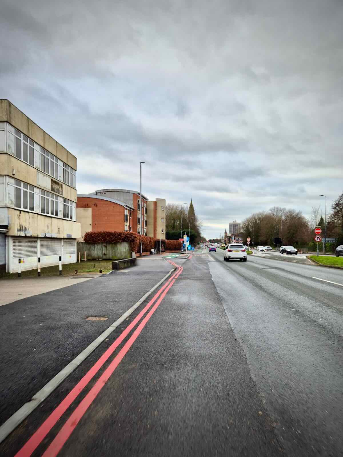
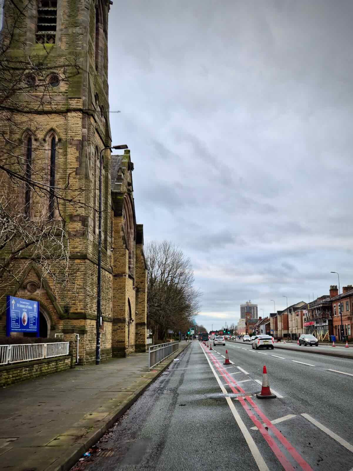
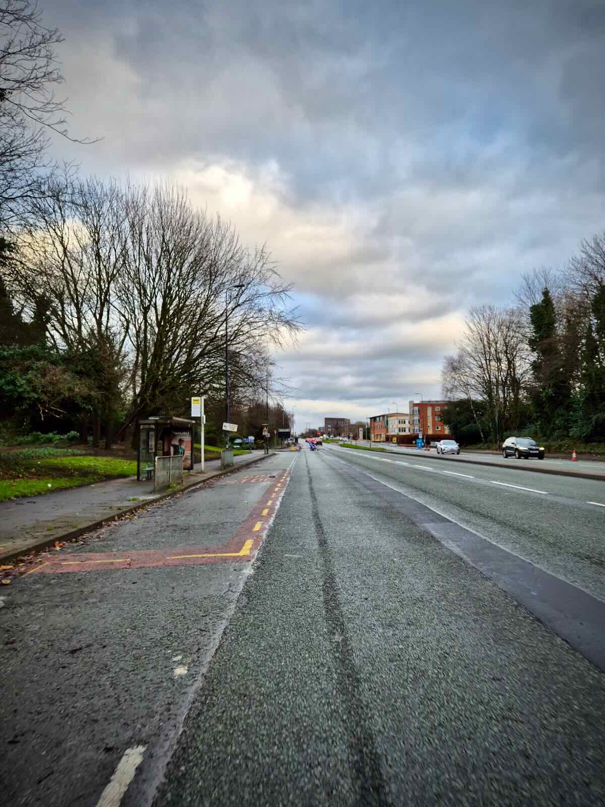
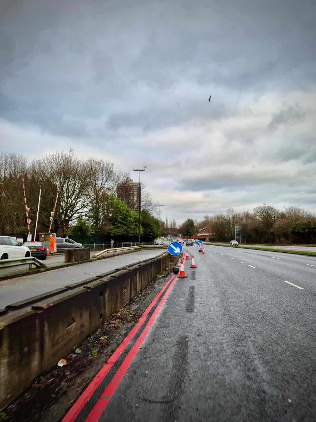
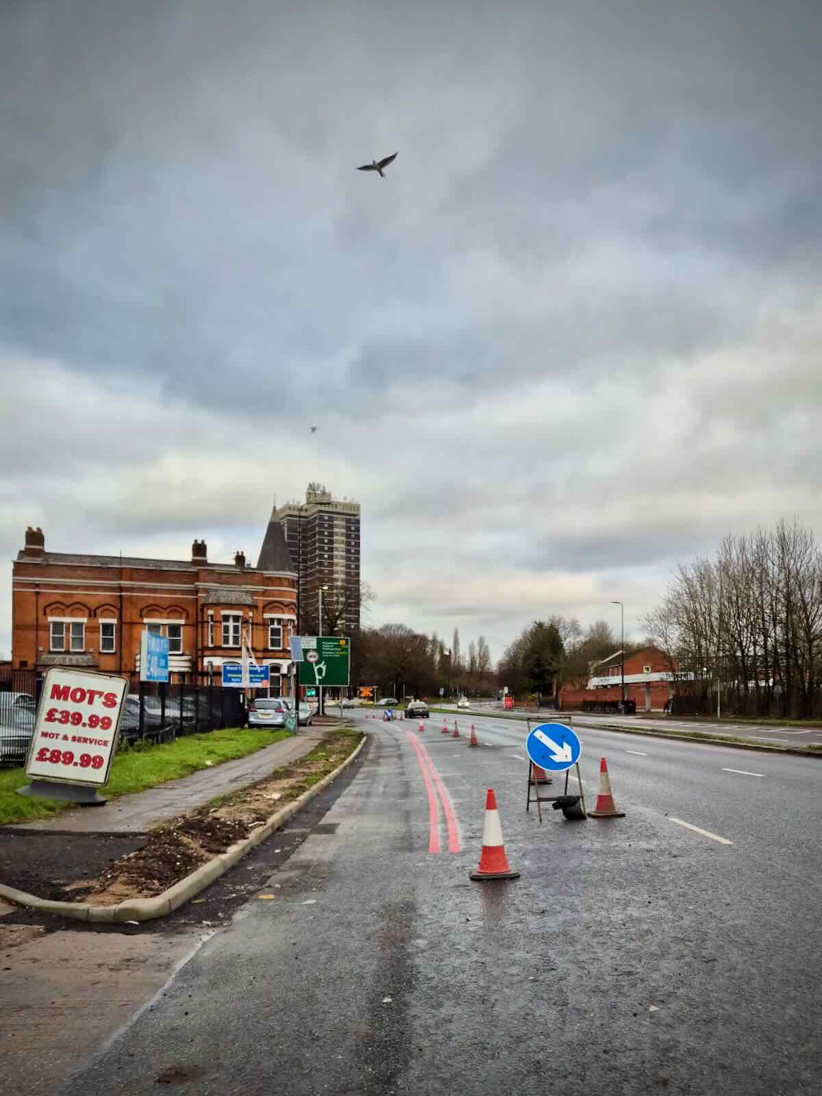
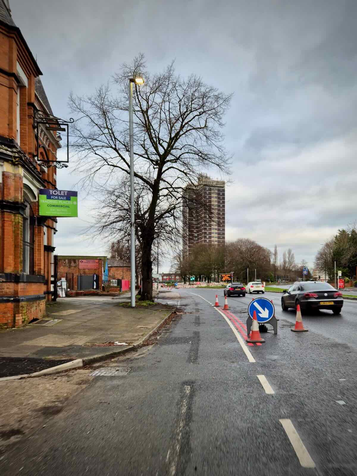
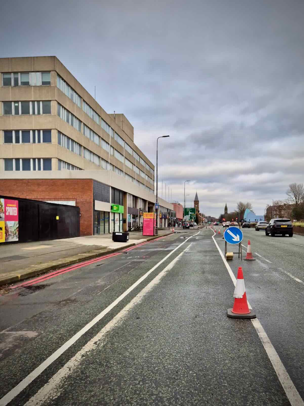
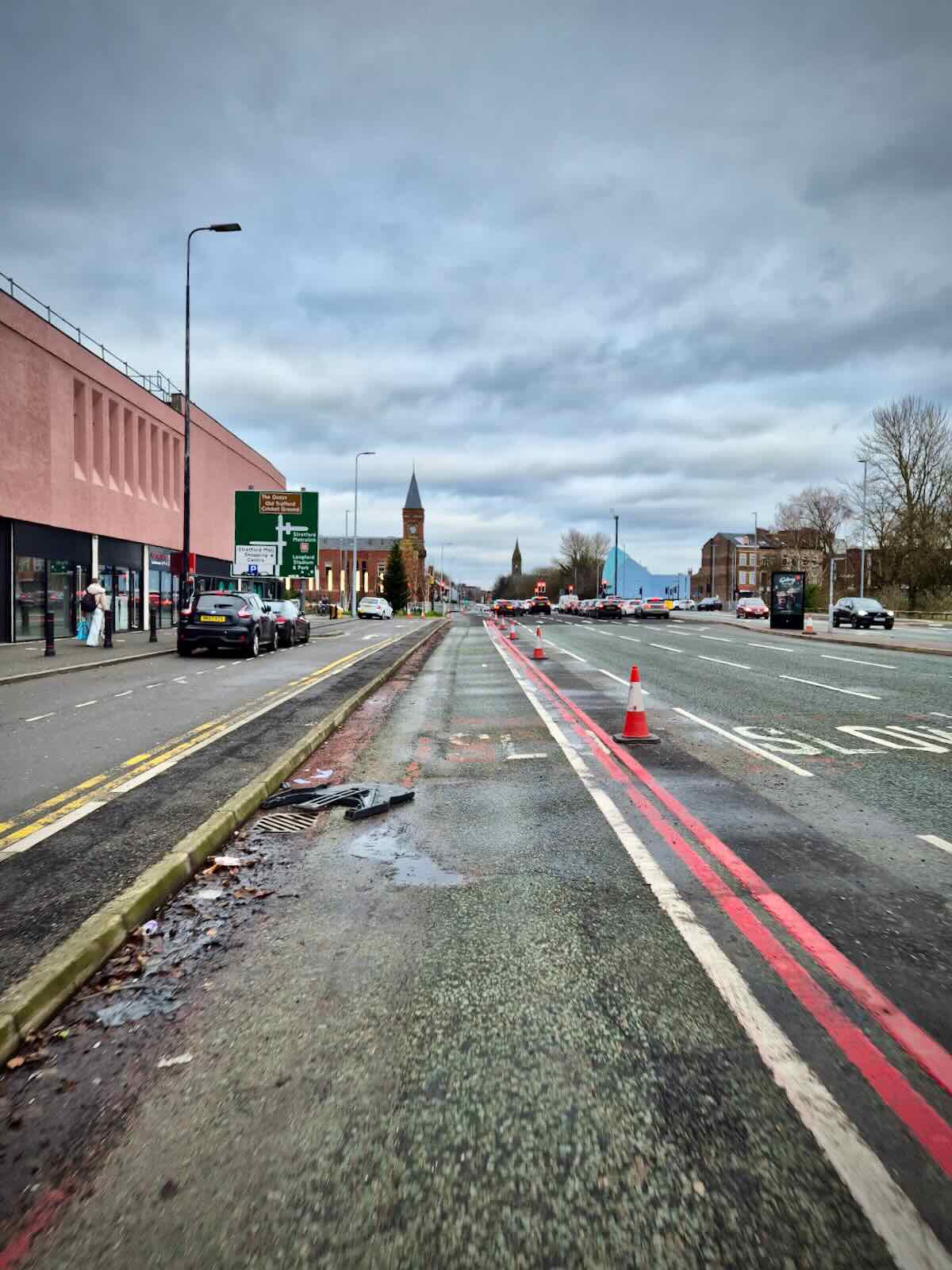
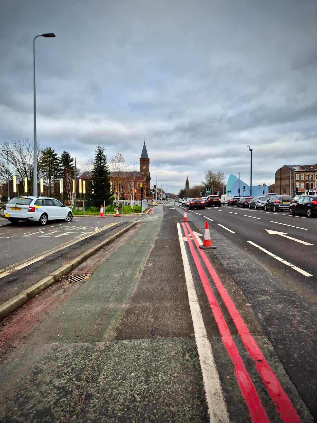
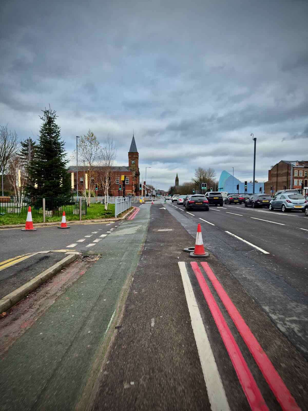
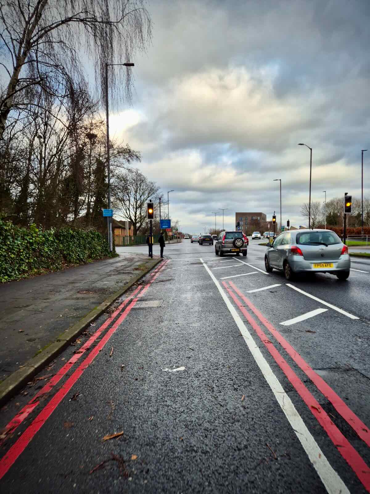
As I write, much of the work has already been done, with many of the bus stop bypasses installed and new white lines painted delineating the new cycle lane as well as double red lines, indicating no stopping. There’s more work to be carried out on the northbound side, particularly around the gyratory, as well as at some of the remaining bus stops to be upgraded.
There’s also the wands to be installed, but I suspect they’re waiting for all the other work to be carried out first, before this happens. In the meantime, cones are still in place next to the new white lines.
Southbound
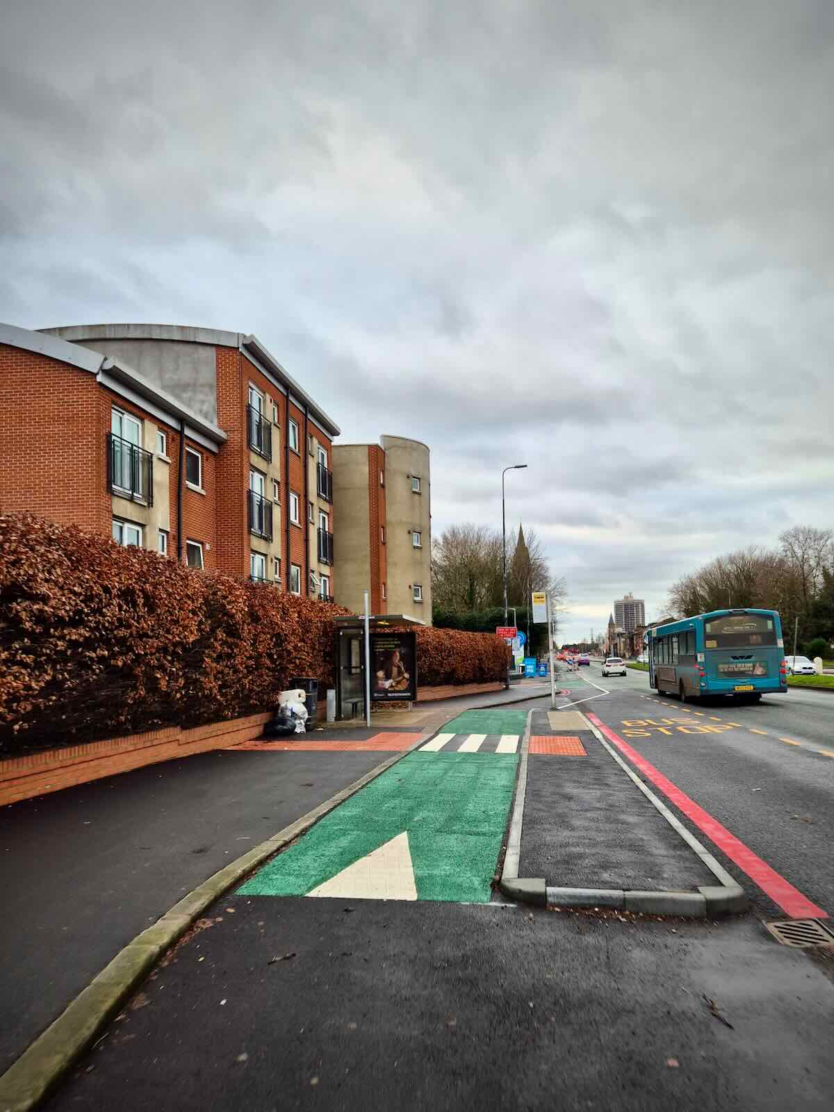
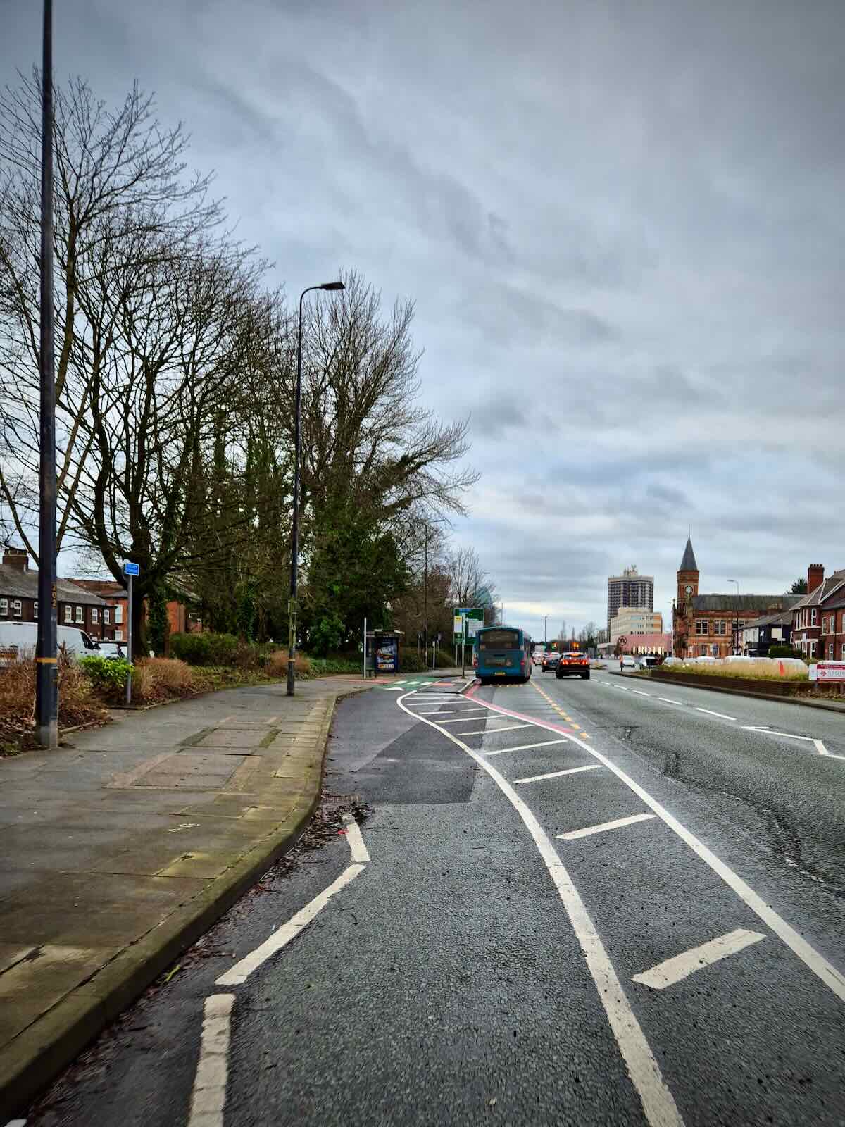
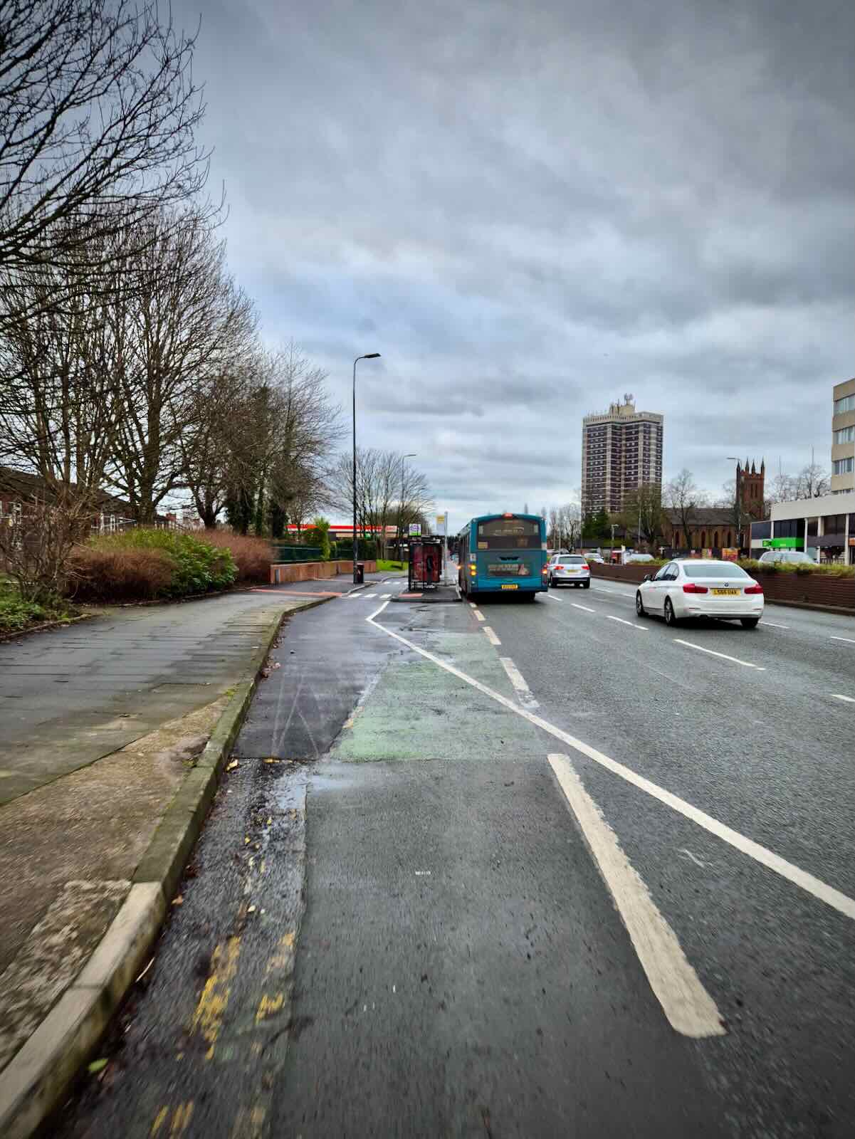
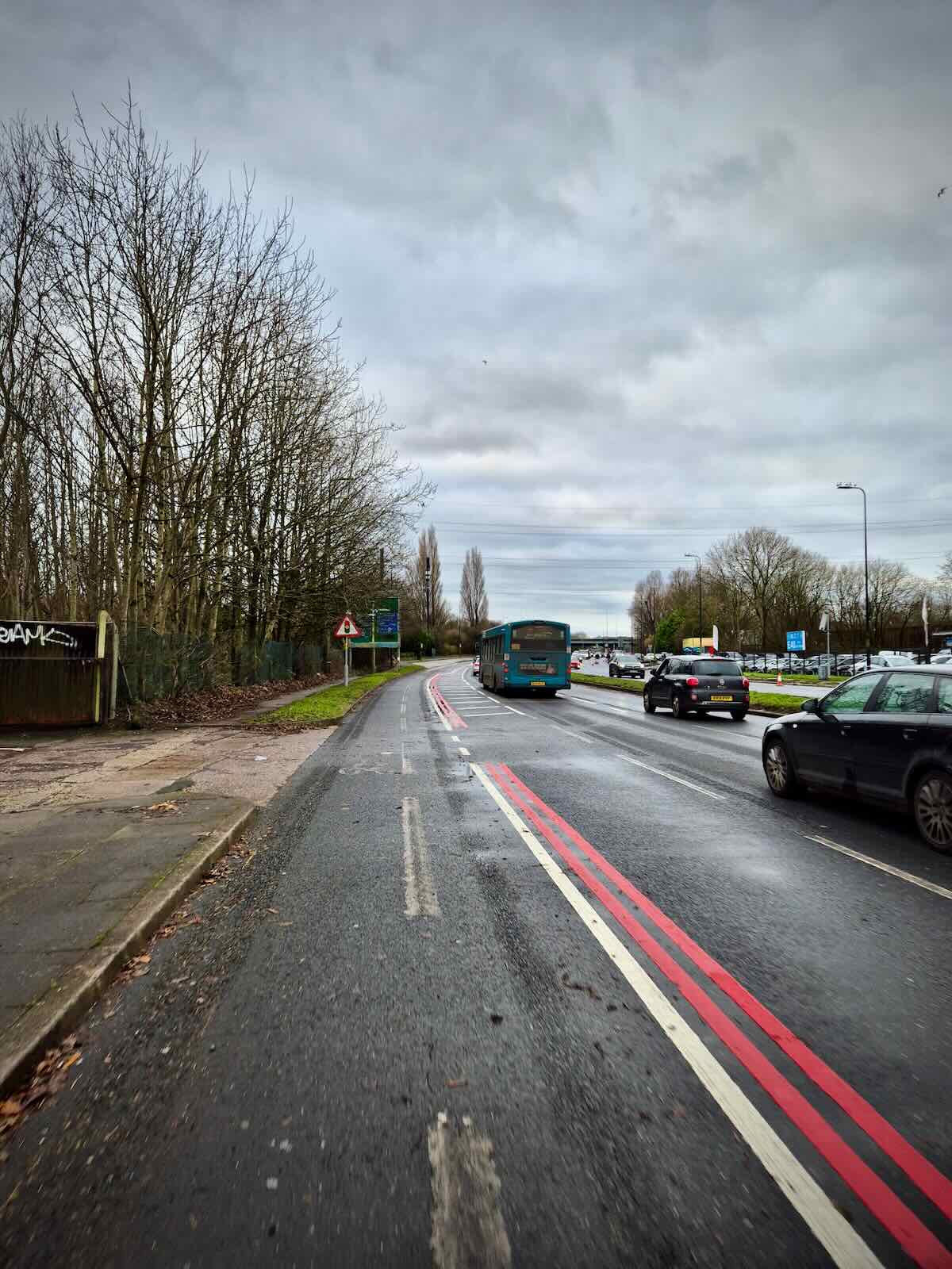
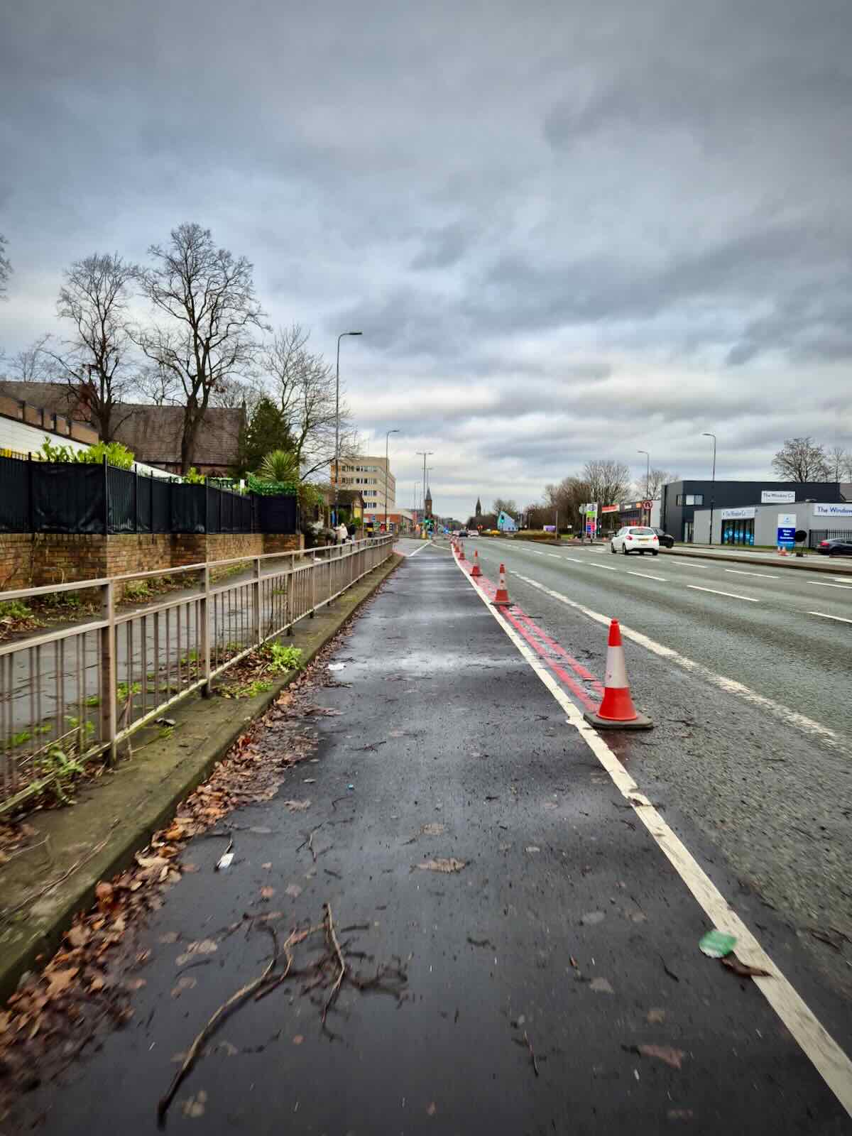
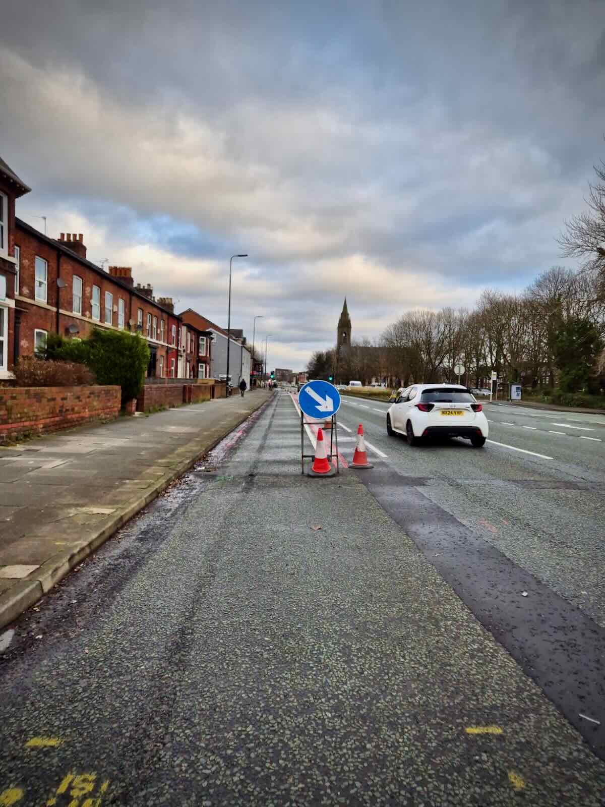
The southbound side is the most advanced of the two sides, with the cycle lane and all of the bus stop bypasses in place. There’s a total of five new bus stop bypasses along this side which significantly improve safety for those cycling along here.
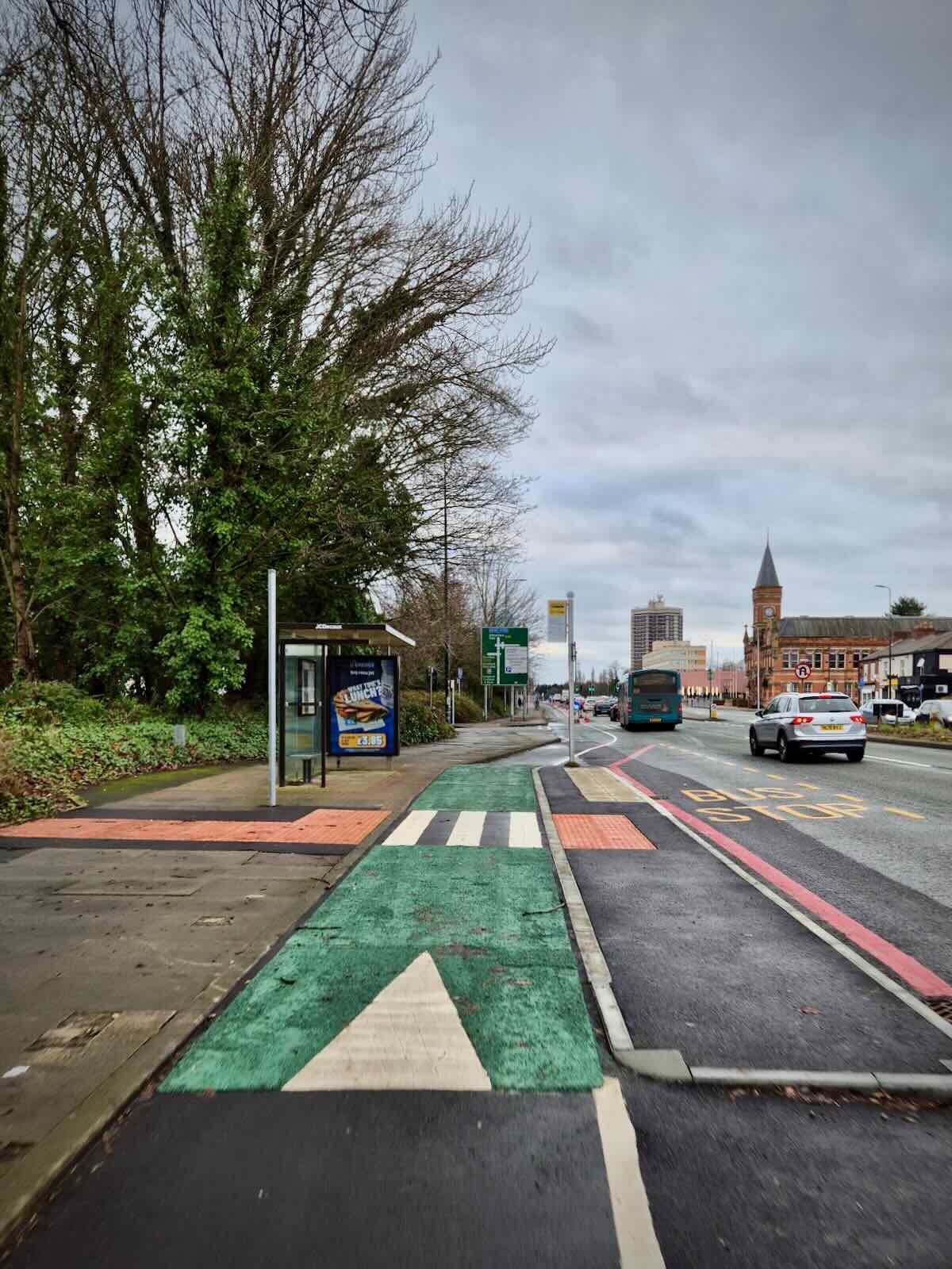
Bus stop bypasses
The original consultation for here didn’t include any bus stop bypasses, proposing that buses and cycles mix at each of the stops, with buses crossing the path of the cycle lane. This was less than ideal and it was something that many of us fed back on.

Now I don’t know if it was a direct result of the consultation feedback or whether there was feedback from other sources, such as from the Mayor’s office or Active Travel England, but it’s really pleasing to see improvements like these made to the original proposals.
Cycle lanes
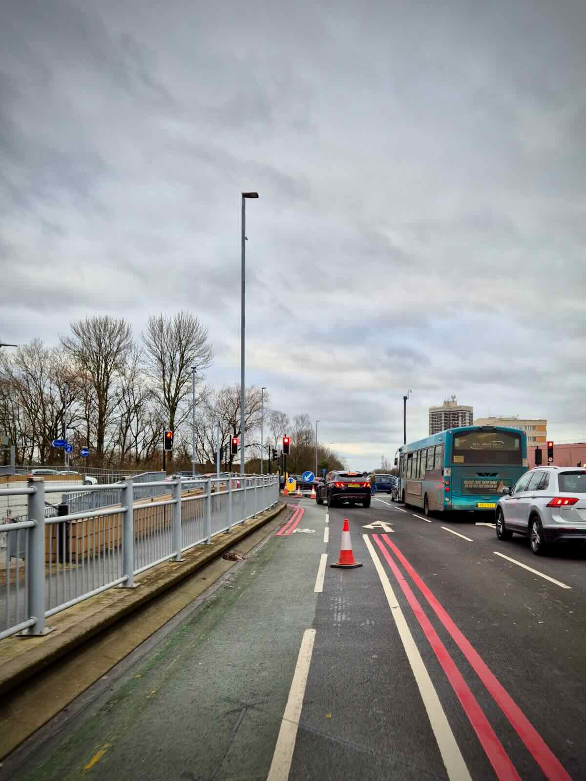
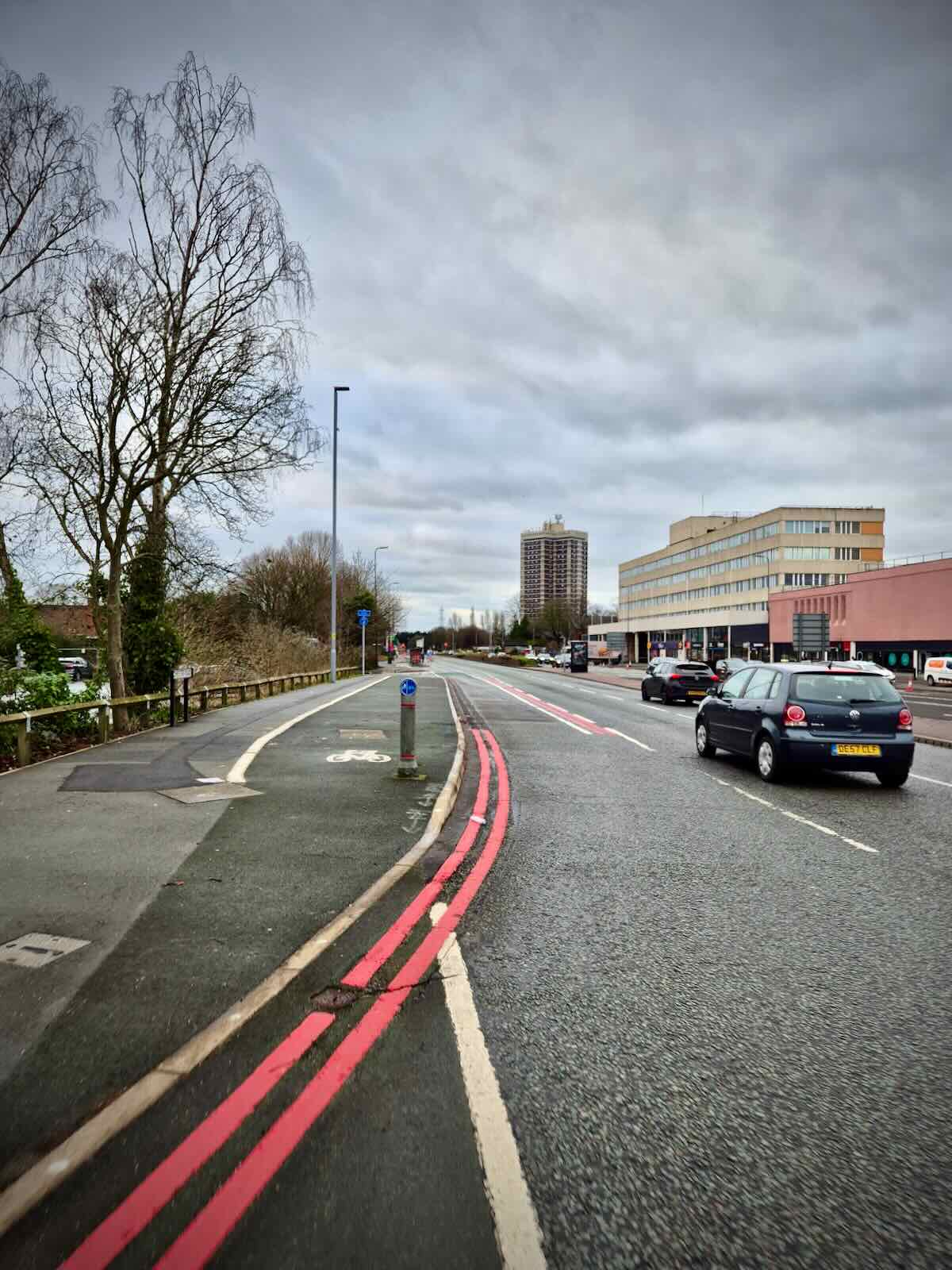
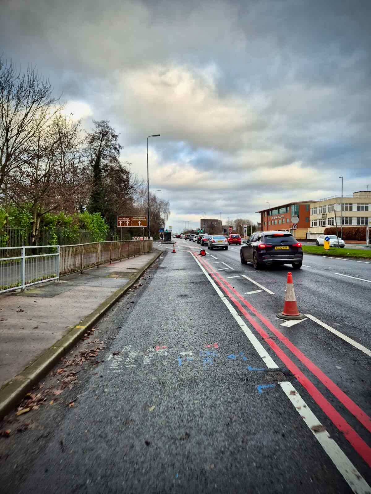
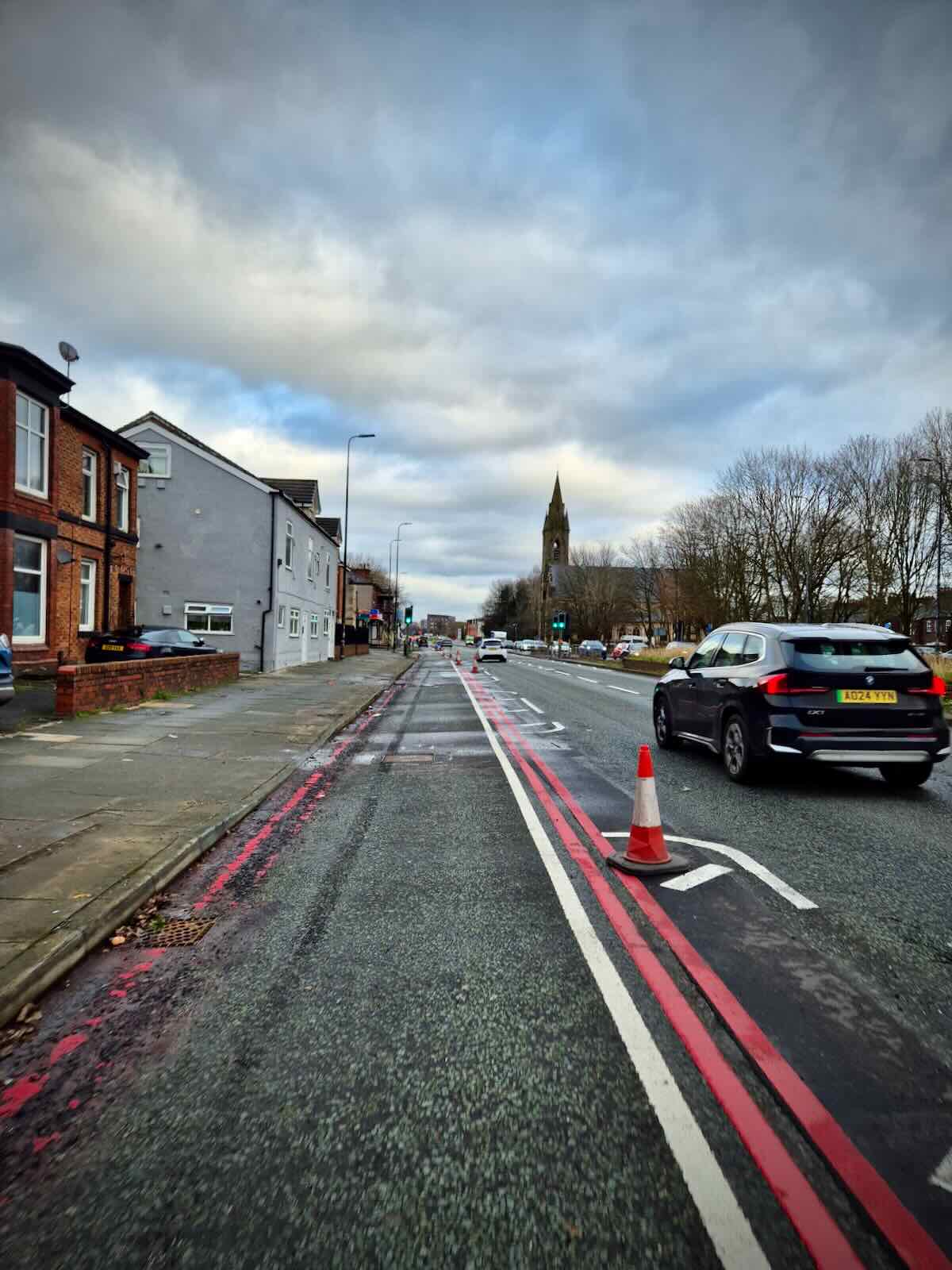
The majority of the southbound route consists of wand-protected carriageway-level cycle lanes, made from what used to be the first of the general traffic lanes, with the number of general traffic lanes reduced to four (two either side).
For much of the route, there’s a buffer between the cycle lane and general traffic lanes. While this is welcome, in terms of putting some distance between cycles and motor vehicles, it means that the cycle lane is narrower than it could be.
This leads to a few drawbacks. Firstly, it makes it difficult to overtake slower cycles without moving out of the cycle lane, this is a common issue on Talbot Road and Stretford Road. It would also have been useful if the lanes could have been bidirectional, enabling people to cycle in both directions without crossing the A56, something which is problematic to do.

Another benefit of wider lanes would have been in enabling access for emergency vehicles to the cycle lane, when responding to emergencies. This is something you see a lot in The Netherlands and even in the UK in London. Heavy traffic on the A56 is often a blocker to emergency vehicles, so this could have been a significant benefit.
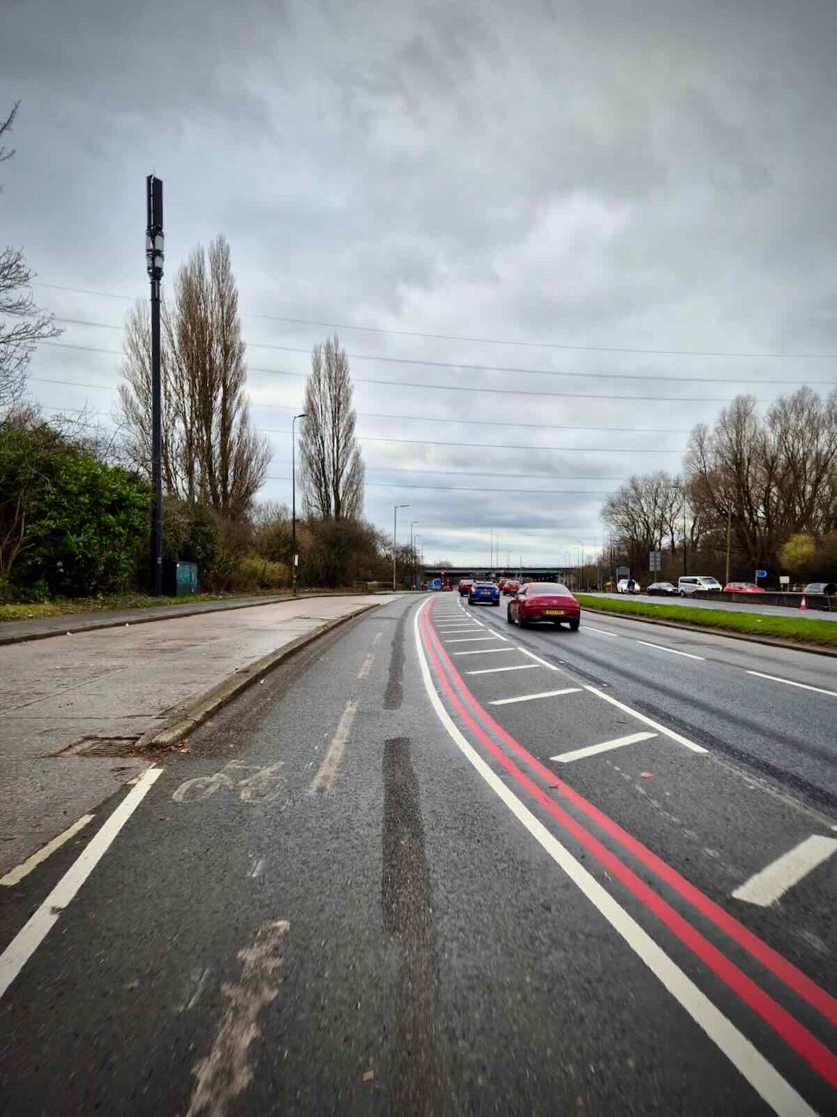
Shared use path
While the majority of the southbound side is at the carriageway level, the initial section after the Talbot Road junction makes use of a footway-level cycle path over Longford Bridge, which is fine. But it then continues as a shared use path until it reaches the first bus stop bypass before Bridgewater Street.

This has been done so that two general traffic lanes can be maintained southbound at the Davyhulme Road East junction, where there’s limited space. I can see why it’s been done, as it would have led to a bottleneck, but it does lead to a compromised solution for cycles.
It’s difficult to see how it could be improved, without a redesign of the Davyhulme Road East junction, something that’s definitely needed, as this is a really dangerous junction to cycle on, if you’re wanting to access Davyhulme Road East.
Plus it puts lots of speeding in front of two primary schools, with drivers paying more attention to getting in front of each other, than looking out for school children.
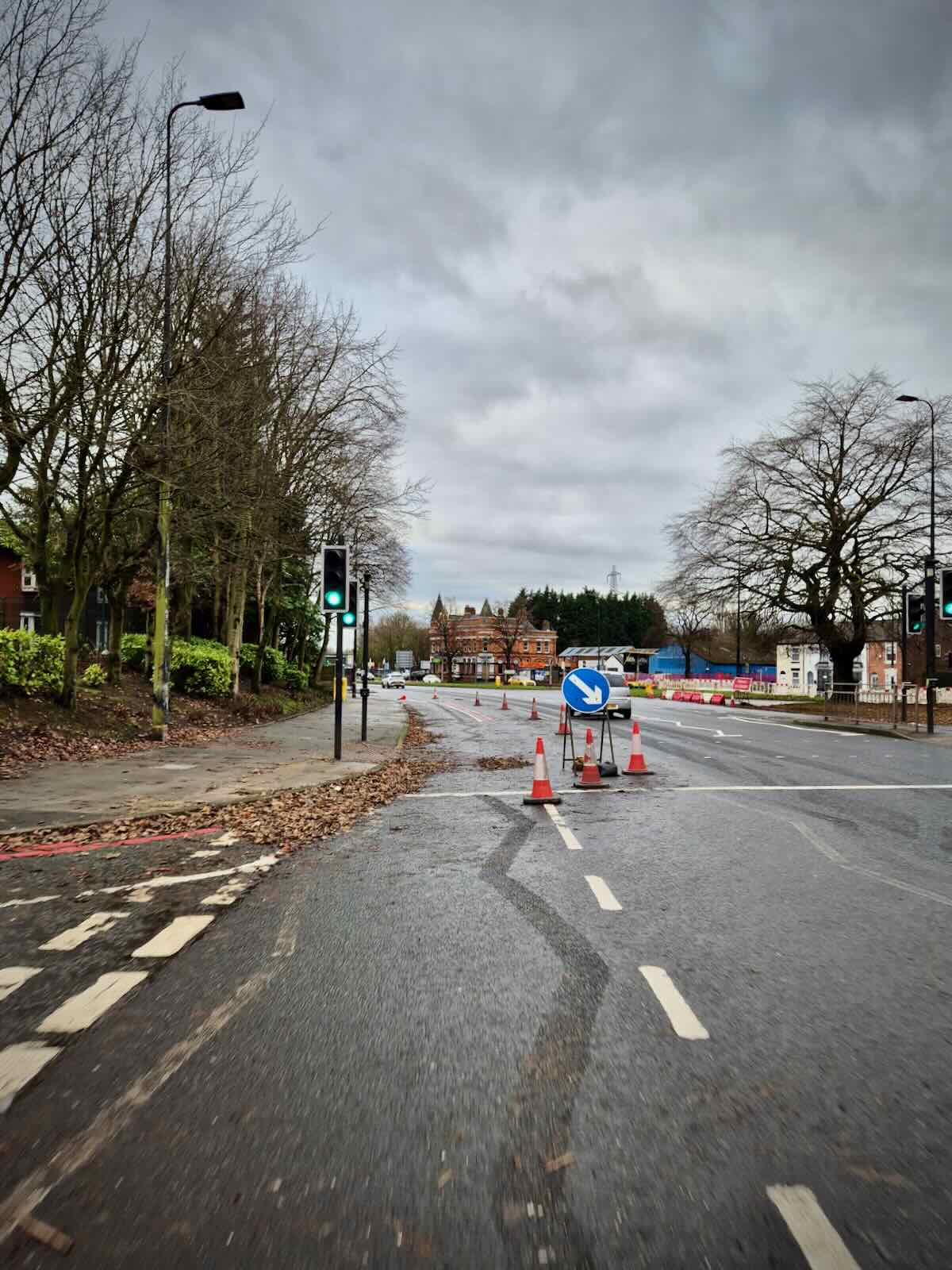
Edge Lane / Kingsway junction
Something that applies to both sides of the A56 are the issues surrounding the Edge Lane / Kingsway junction. There’s no improvements included in the scope of either the A56 or Kingsway improvements, which means we’re left with the mess implemented by the previous Tory executive.
So as you approach the junction, the protection ends and you are left to mix with traffic. This is even more of an issue if you plan to turn right, where there isn’t an obvious way of doing it without dismounting and using the pedestrian crossings or putting yourself in danger by crossing four lanes of traffic.
This is a big junction and implementing safe routes for cycling isn’t going to be easy or cheap, so it’s understandable why it hasn’t been included in the scope, but it is one of the elephants in the room when it comes to this and the Kingsway schemes, as it really is a barrier to people cycling.


Northbound
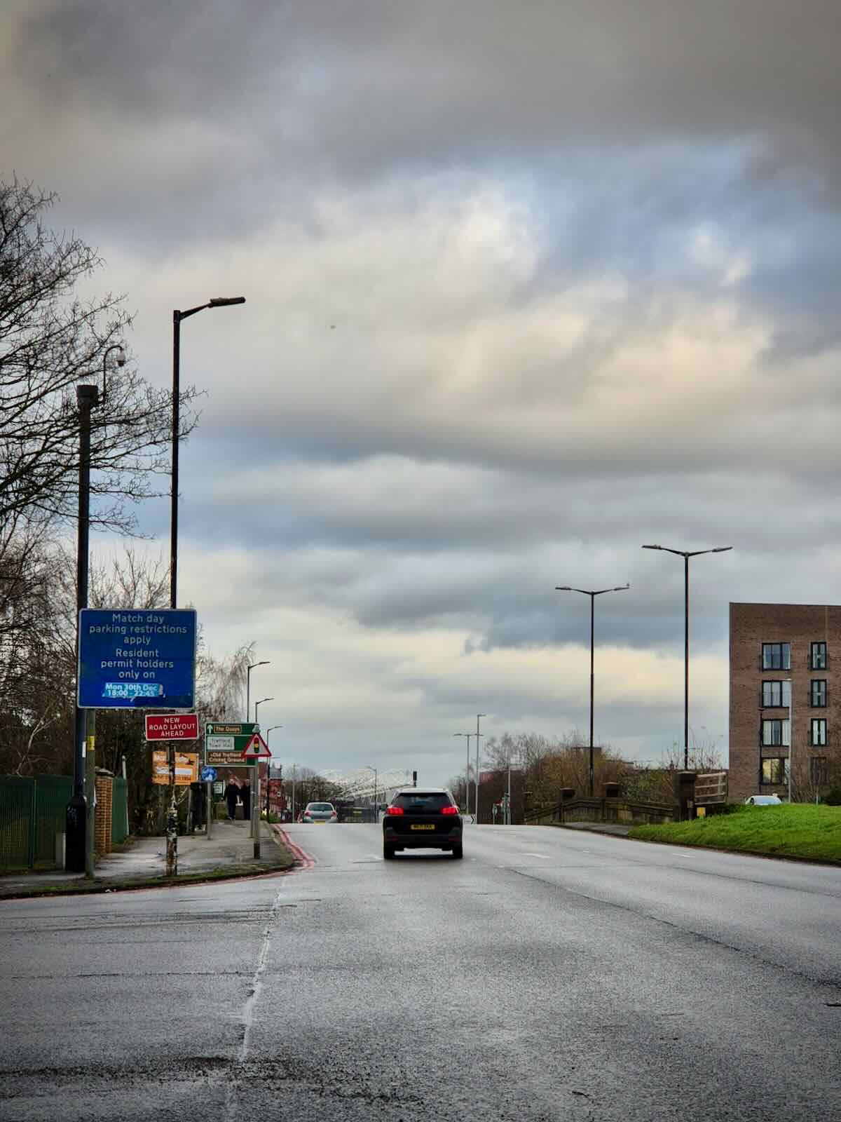
As I’ve mentioned, work on the northbound side of the A56 is definitely lagging behind the southbound side. This is probably partly due to more work being required, particularly around the gyratory and approach to the Derbyshire Lane turning. Though there was also groundworks being carried out early on. I’m not sure what for, but it looked like utilities.
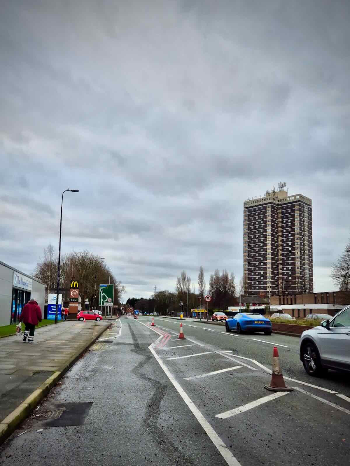
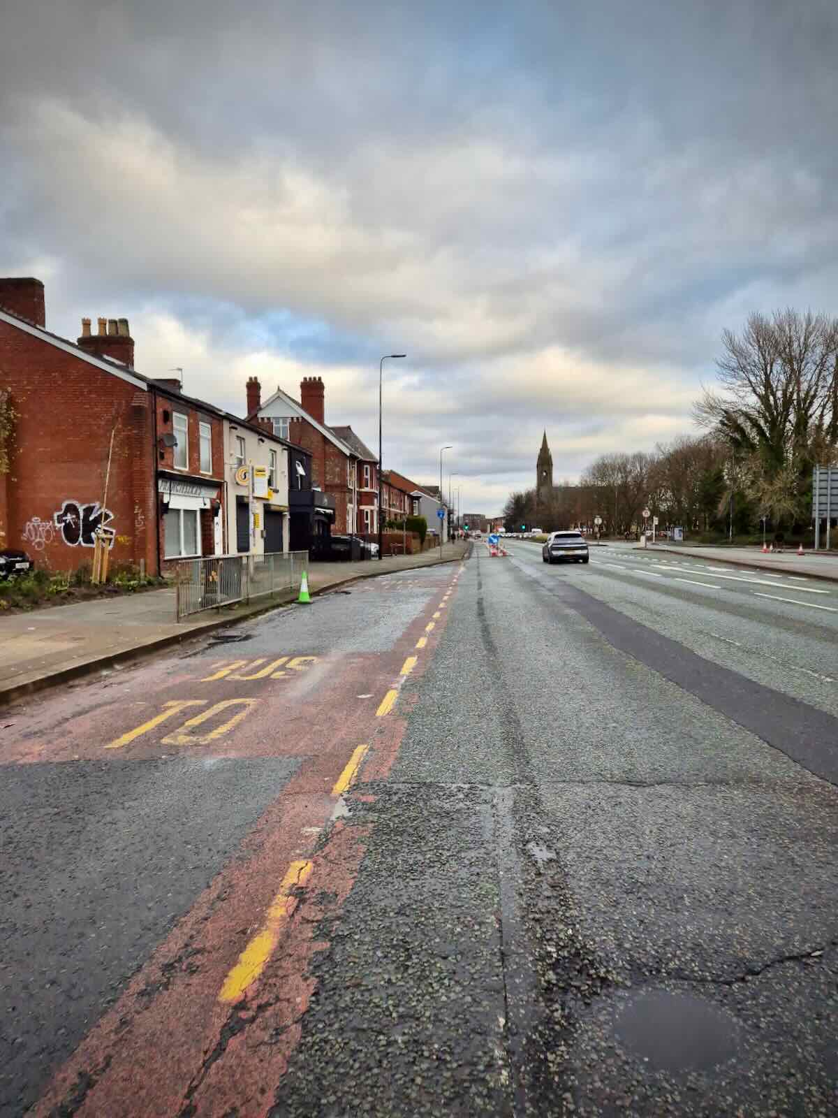
Lack of protection beyond the M60
Probably one of those most talked about issues with the A56 cones, beyond a minority of drivers complaining, is the fact that protection ends at the M60 junction, rather than continuing south to Sale and beyond. This is carried over into the new scheme, with protection ending before reaching the M60 junction.
On the northbound side, protection doesn’t actually start under after the recycling centre, next to the car dealership. This means most sensible people will likely choose to ride on the footway, rather than risking their lives in an impossibly narrow advisory cycle lane, with traffic speeding past them.

This is one of the other elephants in the room with the A56 scheme, as those in the south of the borough quite rightly want a safe way to cycle towards the city centre, that can be used all year round, in both the day and night. This isn’t the case for the Bridgewater Canal path, which is narrow, there’s lots of conflict with other users and it often doesn’t feel safe, particularly at night.
There isn’t an easy option to continue south of the Dane Road junction, four lanes of traffic have already been been shoehorned in along here, with footways not particularly spacious. So you’re either looking at taking away general traffic lanes or creating some kind of compromised shared use solution.
An alternative would be a parallel route to the A56, which is something the council were considering. Potentially, the proposed Sale Active Neighbourhood could have helped with this, at least for parts of the route. But as this was axed, that’s no longer on the table.
While it may not be the best news for those in the south of the borough, I don’t think this is something we should focus on for now. I’ll come onto why later.
The Gyratory
The Gyratory has always posed a challenge for providing safe space for cycling. This was also true for the A56 pop-up lanes, where it was often difficult and dangerous to get from the coned section and across the Barton Road turning, so you could carry on along the A56.
Going back to the original public realm proposals for Stretford by the previous Tory executive, there were plans to remove the gyratory, which ultimately makes sense, but the solutions put forward were truly woeful for walking and cycling. No surprise there.
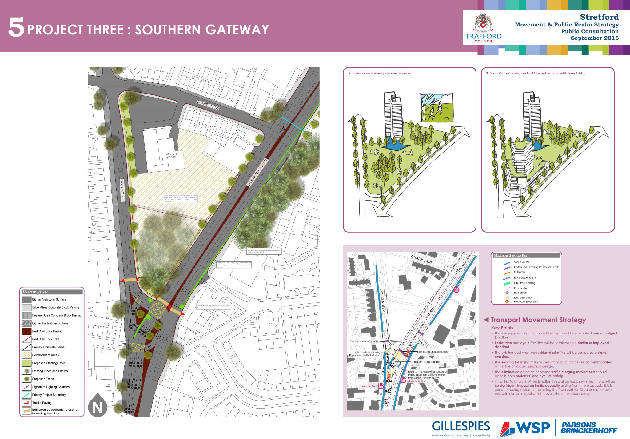
The initial proposals for the A56 scheme included a cycle route along the central island for people walking and cycling, requiring the use of two signalled crossings, which no doubt would have taken a while to use.
I’m pleased that an alternative solution has been arrived upon, which means people cycling carry on until the Barton Road turning, where a new signalled crossing is to be installed, enabling people to carry on along the A56 safely. Though there is an outstanding question as to how responsive that crossing will be. From what we’ve seen at other junctions with cycle crossings, not very.

The section from Poplar Road to Barton Road will consist of a new bypass, which will be to the inside of some existing parking bays and a pedestrian crossing. This is currently under construction.
Stretford Mall
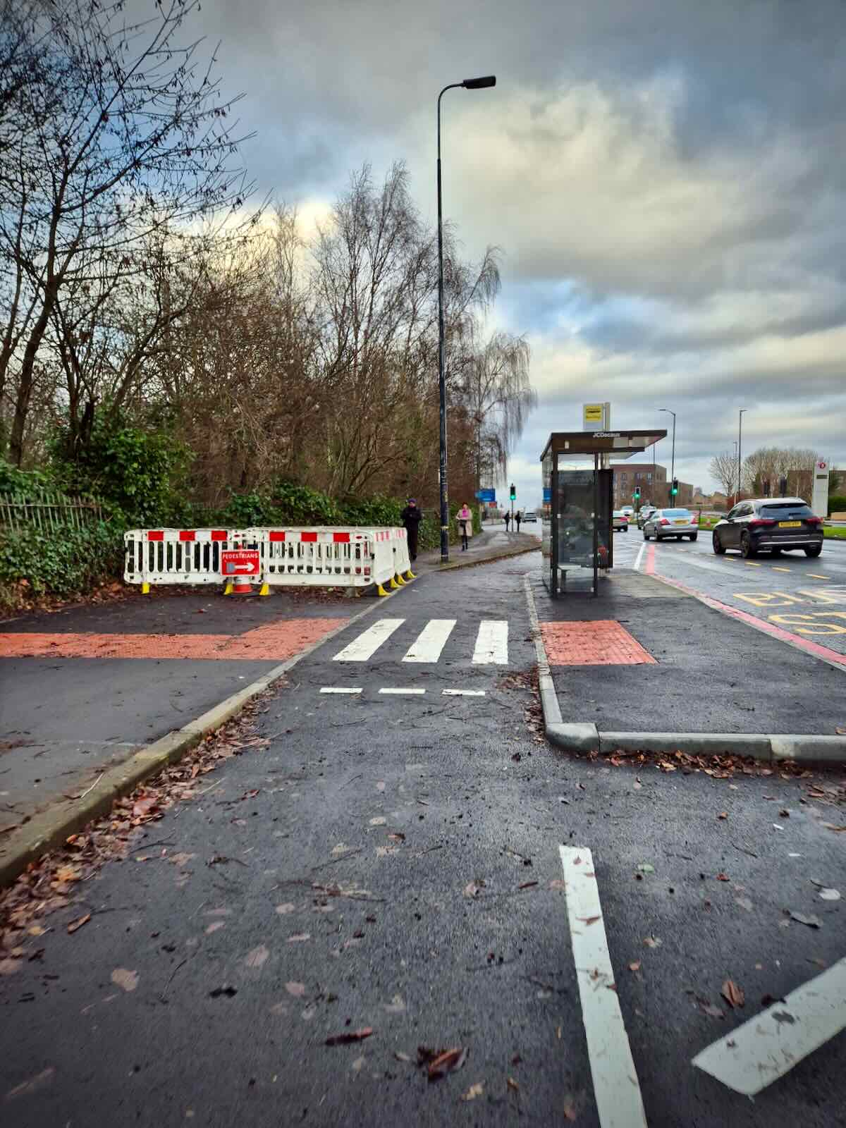
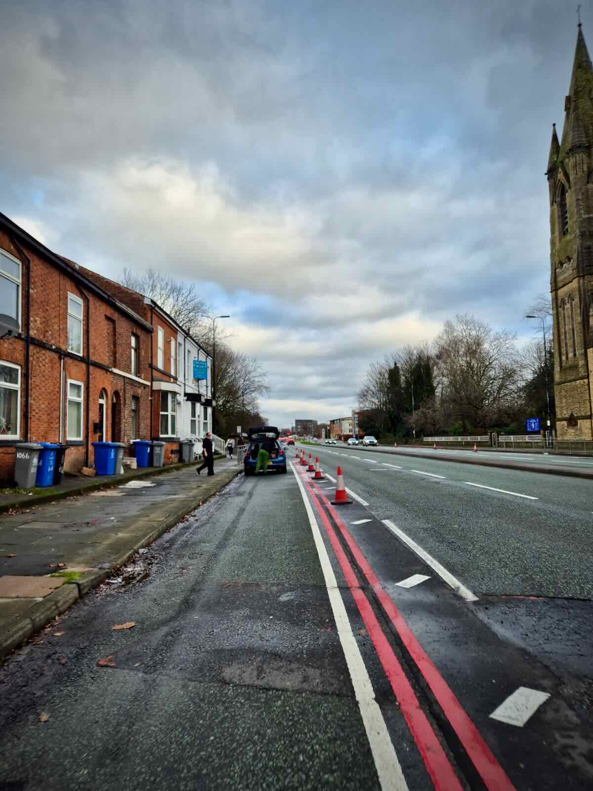
Beyond the gyratory, the new cycle lane continues past St Matthew’s before arriving at Stretford Mall. At this point, the slip road for the car park entrance and bus stop is being filled in, which is an improvement. Though there’s still a conflict point here, as this bus stop won’t be bypassed.

Though after the bus stop, the section of bus lane that continues to the service entrance of Stretford Mall is being removed, which is sensible. Beyond that, up to the Edge Lane / Kingsway junction, nothing much changes, other than the addition of the cycle lane.
Stretford Public Hall to the Derbyshire Lane turning
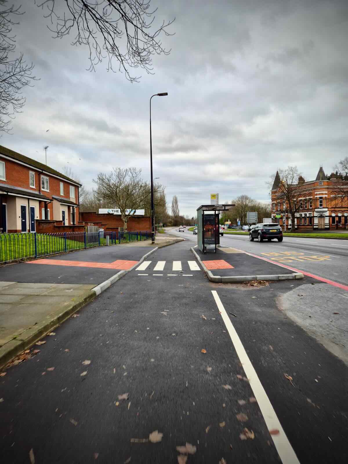
After the Edge Lane / Kingsway junction, the new cycle lane continues, with a yet to be built bus stop bypass after Stretford Public Hall and a new dropped kerb for cycles to access Herbert Street.
It then continues along the A56 to where the existing bus stop is on the slip road to Derbyshire Lane. A new bus stop bypass will be built here and the slip road removed, to create a turning more appropriate for a 30 mph road. Changes like this should help to make the A56 feel less like the urban motorway that it was originally intended to be.
With the removal of the guardrails that’s already happened, it should start to improve driver behaviour, meaning people drive at more appropriate speeds for the conditions. Though I’d say there’s still more work needed on this, potentially with the inclusion of average speed cameras too.
Derbyshire Lane to Longford Bridge
Beyond Derbyshire Lane, there’s still some of the old guardrails in place, which are not being removed. I’m not entirely sure why these have been kept, but it means the footway is much narrower here than it could be, as there’s a reasonable amount of wasted space on the other side of the guardrails.
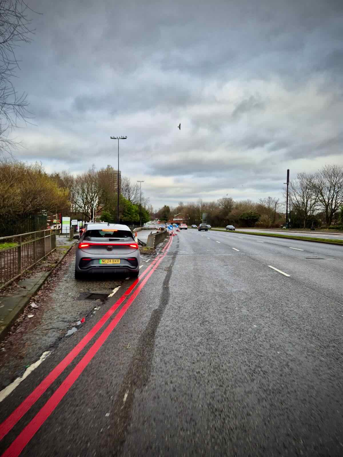
The bus stop before Davyhulme Road East has been upgraded to a bus stop bypass and is almost complete, except for some work remaining on the footway. From there, the cycle lane continues until it reaches the Davyhulme Road East junction.
The protected cycle lane is due to continue onto Longford Bridge, where it will connect up to the new Talbot Road junction. This will be really welcome, as while the new junction makes it much safer to continue onto Talbot Road, getting to the junction is pretty hairy right now, as vehicles speed along here and drivers have no qualms about close passing you.


Detailed designs
The following are the detailed designs for the scheme, across three sheets, select an image to view a bigger version or download the individual PDFs.
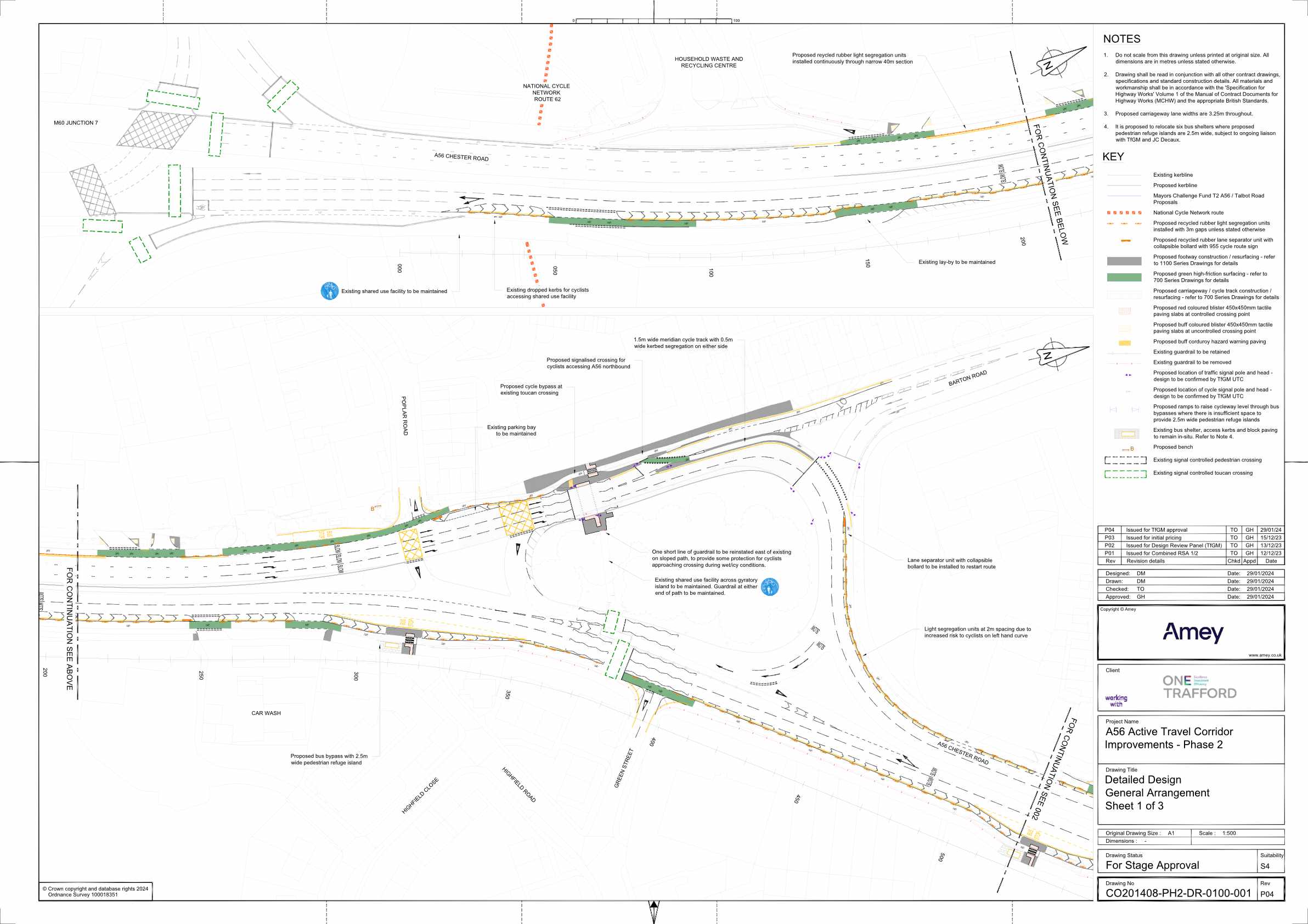
Download: Sheet 1 of 3 PDF (1.30 MB)

Download: Sheet 2 of 3 PDF (1 MB)
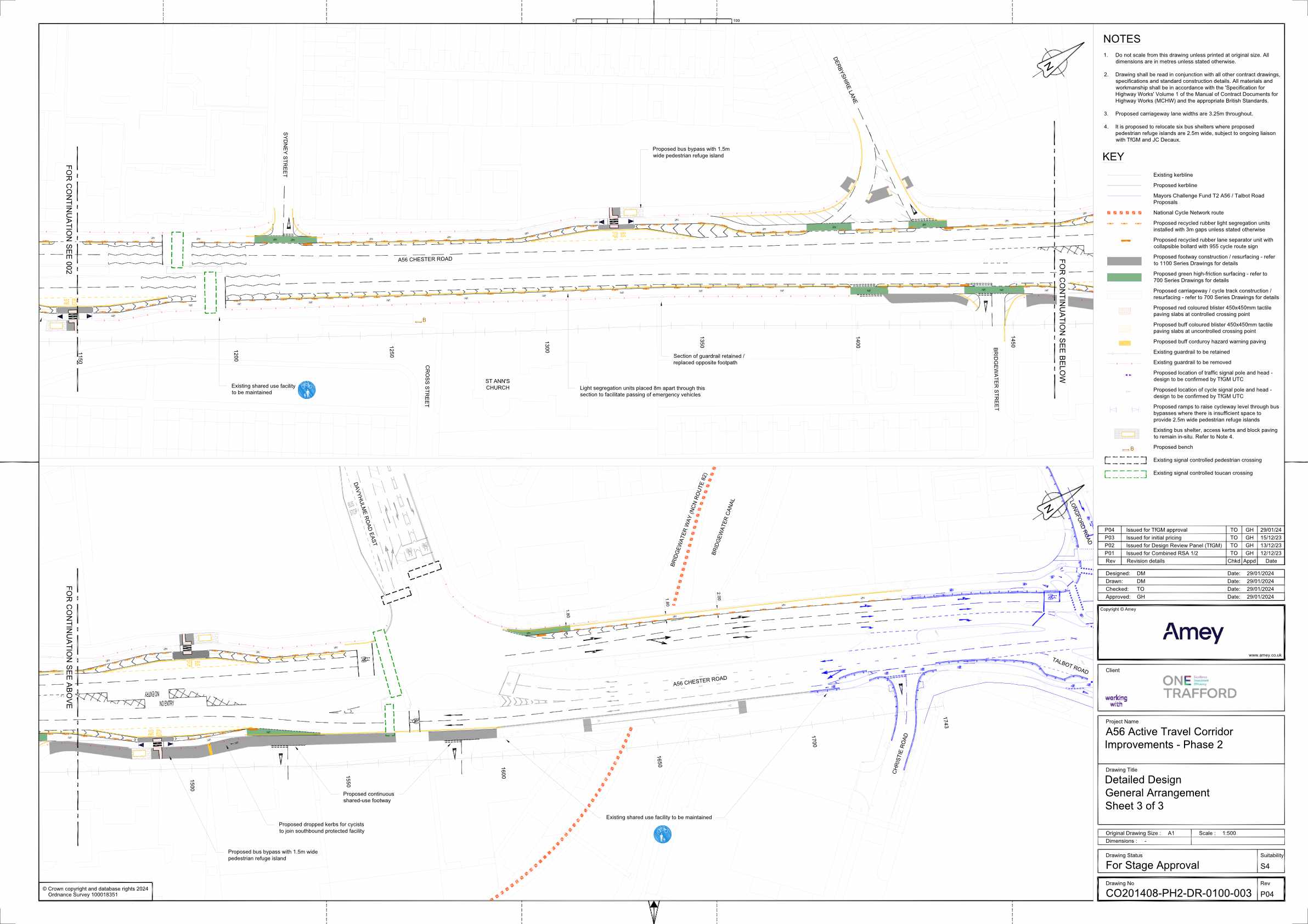
Download: Sheet 3 of 3 PDF (1 MB)
What’s next?
As I’ve mentioned already, there’s two key issues that need to be addressed, the dangerous Edge Lane / Kingsway junction and the lack of protection beyond the M60. Let’s go over these further.
Edge Lane / Kingsway junction
This is a really dangerous and unpleasant junction, which the work carried out by the previous Tory executive made worse by removing the underpasses that were much safer and convenient to use than the surface crossings, but needed to work to address issues with social safety.
With the underpasses filled, the only option really is to reconfigure the junction at the surface level to provide safe space for cycling, most likely as a large CYCLOPS style junction. Part of this work should also focus on improving the experience for pedestrians, as crossing the junction right now is an absolute nightmare.
The improvements to the A56 and Kingsway will mean larger numbers of people cycling through this junction, which will inevitably lead to collisions and potentially fatalities. I don’t want to sound alarmist, but it’s that simple. So making this junction safe for cycling needs to be made a priority.
Extending protection beyond the A56 in Stretford
I mentioned above that I don’t think extending to the south of borough should be the focus. The reason I say this is that I don’t believe it’s the most effective way of maximising the infrastructure that’s been built up to now, and drive the take-up of people cycling, leading to a real modal shift.
So what do I think is a more effective way of doing this? I believe we need to focus on connecting the A56 scheme up with other local schemes, so we can begin to build a true cycle network, as well as looking at how we can link to other population areas close to, but not directly on the A56.
What does that mean in reality? We should focus on creating an east/west route, starting in Flixton and passing through Urmston, then linking up to the new Kingsway scheme and across the A56 to Edge Lane to connect to the new Chorlton Cycleway. It would then eventually continue east, linking to Didsbury, Heaton Mersey and on to Stockport.
While providing safe cycle infrastructure on the A56 will definitely add value, we’ll only see real change once it becomes part of a true cycle network, effectively increasing the catchment of people who are able to use it.
Just doing the A56 in isolation will mean it’ll only ever be used by those close by or brave enough to cycle further to reach it. For example, there isn’t an attractive route from the west of Stretford, as it’s either means using the busy Stretford Road / Urmston Lane route or one of the parallel routes that are plagued by rat-running.
Easy wins
In addition to above, there’s two further easy wins that would extend what’s been done on the A56, to link it with the wider cycle network. First is addressing the gap in protection on the A56, between the Bridgewater Expressway and the Deansgate Interchange. This is a really horrible place to ride right now and is definitely a blocker to more people using the route more.
Second is addressing the missing link along Stretford Road in Hulme, where the Stretford Cycleway should connect to the Oxford Road Cycleway, but currently finishes at the Manchester border.
Conclusion
While that’s all for the future, I do want to take a moment to recognise the fantastic work done by Trafford Council and its executive to reach this point, despite a very vocal minority, no doubt orchestrated by the woefully out of touch Trafford Tories, who still don’t seem to grasp that their pro-car stance isn’t the vote winner they think it is.
In particular, I want to recognise the great work done by council leader Tom Ross, and exec member for climate change Aidan Williams. There’s a reason Trafford Council recently won GM council of year in the 2024 Walk Ride GM awards.
In addition, while he did once label me as “the worst”, we should also recognise the previous council leader, now Stretford MP Andrew Western, for taking the brave decision to install the original A56 pop-up cycle lanes during lockdown.
